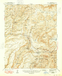
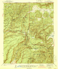
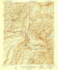
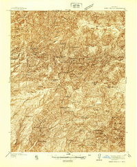
1944 Map of Jemez Springs
USGS Topo · Published 1948About this map
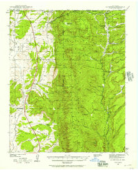
Santa Fe National Forest encompasses the volcanic landscape of the Jemez Mountains in this mid-century survey, revealing a network of ranches, camps, and thermal features. The San Diego River and San Antonio Creek carve through deep canyons, with the notable Soda Dam and Hot Springs marking the geological activity of the region. The settlement of Jemez Springs serves as a central point, while higher elevations are dotted with family-held lands such as Edsall Ranch and Fenton Ranch.
Find a feature on this map
78 named features on this map. Tap any name to fly to it.
Don’t see what you’re looking for? This feature index may not catch every label — zoom into the map to look around manually.
Map Details
Editions of this 1944 Jemez Springs Map
3 editions found
Other maps of this area

1890 · Jemes
USGS Topo · 1:125,000

1892 · Jemes
USGS Topo · 1:125,000

1892 · Santa Clara
USGS Topo · 1:125,000

1909 · Gallina
USGS Topo · 1:125,000

1918 · Abiquiu
USGS Topo · 1:125,000
1937 · Jemez Springs
USGS Topo · 1:48,000
1939 · La Ventana
USGS Topo · 1:62,500

1939 · San Ysidro
USGS Topo · 1:62,500

1940 · Cuba
USGS Topo · 1:62,500

1943 · San Ysidro
USGS Topo · 1:62,500