1944 Map of Jemez Springs
USGS Topo · Published 1944About this map
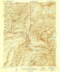
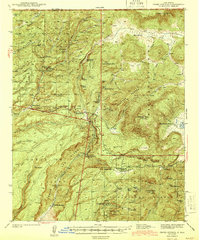
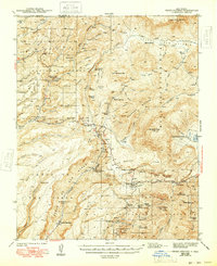
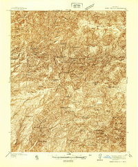
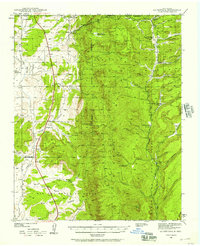
Jemez Springs and the surrounding canyons of the Santa Fe National Forest are captured here during a period of transition in the late 1930s. The settlement at La Cueva and the Battleship Rock CCC Camp reflect the era's federal investment in mountain access and conservation. Volcanic geography dominates the landscape, defined by Redondo Peak and the thermal activity at San Antonio Hot Spring, Sulphur Springs, and the Soda Dam.
Find a feature on this map
72 named features on this map. Tap any name to fly to it.
Don’t see what you’re looking for? This feature index may not catch every label — zoom into the map to look around manually.
Map Details
Editions of this 1944 Jemez Springs Map
3 editions found
Other maps of this area

1890 · Jemes
USGS Topo · 1:125,000

1892 · Jemes
USGS Topo · 1:125,000

1892 · Santa Clara
USGS Topo · 1:125,000

1909 · Gallina
USGS Topo · 1:125,000

1918 · Abiquiu
USGS Topo · 1:125,000
1937 · Jemez Springs
USGS Topo · 1:48,000
1939 · La Ventana
USGS Topo · 1:62,500

1939 · San Ysidro
USGS Topo · 1:62,500

1940 · Cuba
USGS Topo · 1:62,500

1943 · San Ysidro
USGS Topo · 1:62,500