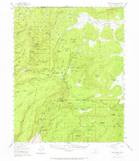
1952 Map of Jemez Springs
USGS Topo · Published 1969About this map
Jemez Springs serves as the focal point for this mid-century survey of the Santa Fe National Forest, where the canyon terrain dictates the placement of settlements and summer camps. The landscape is defined by its hydrothermal activity and geological landmarks, including the notable Soda Dam and Sulphur Springs. Recreation and conservation are evident through the State Fish Hatchery, the Seven Springs Ranger Sta., and Camp Shaver (YMCA) near Battleship Rock. Large private holdings like the Baca Location No 1 and various cattle operations such as Lazy Ray Ranch and Triple H Ranch illustrate the era's land use. High-elevation valleys including Valle San Antonio and Valle Grande contrast with the deep incisions of Cebolla Creek and San Antonio Creek. Traces of earlier inhabitants are preserved at the Indian Ruins, highlighting the long human presence in this volcanic province.
Find a feature on this map
55 named features on this map. Tap any name to fly to it.
Don’t see what you’re looking for? This feature index may not catch every label — zoom into the map to look around manually.
Map Details
Editions of this 1952 Jemez Springs Map
3 editions found

Other maps of this area

1890 · Jemes
USGS Topo · 1:125,000

1892 · Jemes
USGS Topo · 1:125,000

1892 · Santa Clara
USGS Topo · 1:125,000

1909 · Gallina
USGS Topo · 1:125,000

1918 · Abiquiu
USGS Topo · 1:125,000

1937 · Jemez Springs
USGS Topo · 1:48,000

1939 · La Ventana
USGS Topo · 1:62,500

1939 · San Ysidro
USGS Topo · 1:62,500

1940 · Cuba
USGS Topo · 1:62,500

1943 · San Ysidro
USGS Topo · 1:62,500