
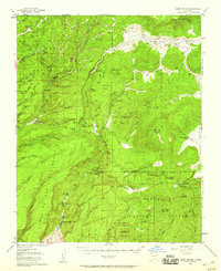
1952 Map of Jemez Springs
USGS Topo · Published 1954About this map
The geological thermal activity of the volcanic landscape is evident in the mid-century topography around Jemez Springs. The map documents a cluster of medicinal and recreational sites along the San Antonio Creek and Rio Fenton, including the famous Soda Dam and the thermal waters of Sulphur Springs. Local agriculture and ranching are represented by landmarks such as the Triple H Ranch and Lazy Ray Ranch, while the presence of the State Fish Hatchery and Seven Springs Ranger Sta. highlights federal and state management of the Santa Fe National Forest. Educational and youth history is marked by Camp Shaver (YMCA), situated near the striking Battleship Rock. Traces of much older habitation appear at the Indian Ruins near the San Juan Mesa, providing a vertical record of settlement from ancient sites to 20th-century outposts like La Cueva.
Find a feature on this map
83 named features on this map. Tap any name to fly to it.
Don’t see what you’re looking for? This feature index may not catch every label — zoom into the map to look around manually.
Map Details
Editions of this 1952 Jemez Springs Map
3 editions found
Other maps of this area

1890 · Jemes
USGS Topo · 1:125,000

1892 · Jemes
USGS Topo · 1:125,000

1892 · Santa Clara
USGS Topo · 1:125,000

1909 · Gallina
USGS Topo · 1:125,000

1918 · Abiquiu
USGS Topo · 1:125,000

1937 · Jemez Springs
USGS Topo · 1:48,000

1939 · La Ventana
USGS Topo · 1:62,500

1939 · San Ysidro
USGS Topo · 1:62,500

1940 · Cuba
USGS Topo · 1:62,500

1943 · San Ysidro
USGS Topo · 1:62,500