
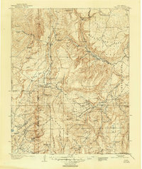
1909 Map of Gallina
USGS Topo · Published 1909About this map
Gallina and the northern reaches of the Jemez National Forest dominate this landscape during a period of early territorial development in New Mexico. The map reveals a complex network of high-elevation mesas and canyons, including Mesa Carson and Mesa Prieta, where the Continental Divide winds through the western quadrant. One of the most striking historical details is the presence of Cliff Dwellings located near the Rio Chama, pointing to the ancient indigenous heritage of the region alongside more contemporary ranching operations like Hart Ranch and Burns Ranch.
Find a feature on this map
117 named features on this map. Tap any name to fly to it.
Don’t see what you’re looking for? This feature index may not catch every label — zoom into the map to look around manually.
Map Details
Editions of this 1909 Gallina Map
2 editions found
Other maps of this area

1883 · Mt. Taylor
USGS Topo · 1:250,000

1886 · Mt. Taylor
USGS Topo · 1:250,000

1889 · Largo
USGS Topo · 1:250,000

1890 · Jemes
USGS Topo · 1:125,000

1892 · Jemes
USGS Topo · 1:125,000

1892 · Santa Clara
USGS Topo · 1:125,000

1892 · Mt. Taylor
USGS Topo · 1:250,000

1895 · Largo
USGS Topo · 1:250,000

1899 · Mt. Taylor
USGS Topo · 1:250,000

1918 · Abiquiu
USGS Topo · 1:125,000