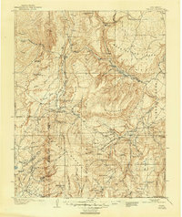
1909 Map of Gallina
USGS Topo · Published 1946About this map
San Pedro Mountains and the high plateaus of northern New Mexico dominate this 1906–1907 survey, which captures the region's isolated ranching and mining outposts. The landscape is defined by the Continental Divide, with water systems like the Rio Chama and Rio Puerco carving through massive landforms such as Mesa de los Viejos and Mesa Prieta. The map identifies the remote Copper City near Cuba, evidence of the early 20th-century mineral interest that drew prospectors to the high desert.
Find a feature on this map
61 named features on this map. Tap any name to fly to it.
Don’t see what you’re looking for? This feature index may not catch every label — zoom into the map to look around manually.
Map Details
Editions of this 1909 Gallina Map
2 editions found
Other maps of this area

1883 · Mt. Taylor
USGS Topo · 1:250,000

1886 · Mt. Taylor
USGS Topo · 1:250,000

1889 · Largo
USGS Topo · 1:250,000

1890 · Jemes
USGS Topo · 1:125,000

1892 · Jemes
USGS Topo · 1:125,000

1892 · Santa Clara
USGS Topo · 1:125,000

1892 · Mt. Taylor
USGS Topo · 1:250,000

1895 · Largo
USGS Topo · 1:250,000

1899 · Mt. Taylor
USGS Topo · 1:250,000

1909 · Gallina
USGS Topo · 1:125,000