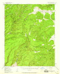
1952 Map of Jemez Springs
USGS Topo · Published 1960About this map
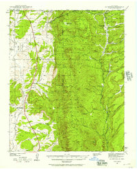
Jemez Springs serves as the focal point of this mid-century landscape, situated along the Jemez River within the Cañon de San Diego Grant. The map illustrates a region defined by complex geothermal activity and deep canyons, featuring landmarks like the Soda Dam Hot Spring and the high elevation of Redondo Peak. To the east, the sprawling high mountain meadows of the Valle Grande and Valle San Antonio indicate the unique volcanic geography of the area. This 1952 revision provides a window into a period when recreational and agricultural interests coexisted, evidenced by the presence of Camp Shaver (YMCA), the State Fish Hatchery, and several private holdings like the Triple H Ranch and Fenton Ranch. Cultural markers such as Indian Ruins and the settlement of Vallecitos de los Indios underscore the long-standing human presence in this portion of the Santa Fe National Forest.
Find a feature on this map
74 named features on this map. Tap any name to fly to it.
Don’t see what you’re looking for? This feature index may not catch every label — zoom into the map to look around manually.
Map Details
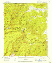
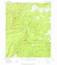
Editions of this 1952 Jemez Springs Map
3 editions found
Other maps of this area

1890 · Jemes
USGS Topo · 1:125,000

1892 · Jemes
USGS Topo · 1:125,000

1892 · Santa Clara
USGS Topo · 1:125,000

1909 · Gallina
USGS Topo · 1:125,000

1918 · Abiquiu
USGS Topo · 1:125,000
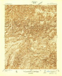
1937 · Jemez Springs
USGS Topo · 1:48,000
1939 · La Ventana
USGS Topo · 1:62,500

1939 · San Ysidro
USGS Topo · 1:62,500

1940 · Cuba
USGS Topo · 1:62,500

1943 · San Ysidro
USGS Topo · 1:62,500