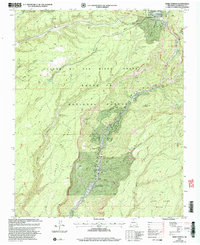
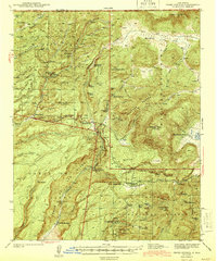
2002 Map of Jemez Springs
USGS Topo · Published 2003About this map
Jemez Springs serves as the focal point of this 2002 revision, situated within the steep confines of San Diego Canyon. The landscape is defined by the massive volcanic geography of the Santa Fe National Forest, where high plateaus like Schoolhouse Mesa and San Juan Mesa overlook the deep drainage of the Jemez River. Geologic and historical points of interest are abundant along the river corridor, including the travertine formation of the Soda Dam, the towering Battleship Rock, and the State Monument marking the area's deep history. Settlement is concentrated in the canyon floor, where a Post Office and Jemez Ranger Station support the local community. To the north, Fenton Lake State Park and the settlement of La Cueva mark the transition toward higher elevations and the numerous thermal features such as Spence Hot Sprs.
Find a feature on this map
53 named features on this map. Tap any name to fly to it.
Don’t see what you’re looking for? This feature index may not catch every label — zoom into the map to look around manually.
Map Details
Editions of this 2002 Jemez Springs Map
This is the sole edition of this map. No revisions or reprints were ever made.
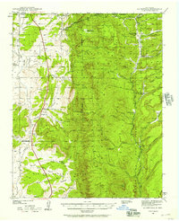
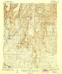
Other maps of this area

1890 · Jemes
USGS Topo · 1:125,000

1892 · Jemes
USGS Topo · 1:125,000
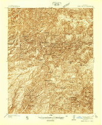
1937 · Jemez Springs
USGS Topo · 1:48,000
1939 · La Ventana
USGS Topo · 1:62,500

1939 · San Ysidro
USGS Topo · 1:62,500

1943 · San Ysidro
USGS Topo · 1:62,500
1943 · Jemez
USGS Topo · 1:62,500

1943 · La Ventana
USGS Topo · 1:62,500
1944 · Jemez Springs
USGS Topo · 1:62,500
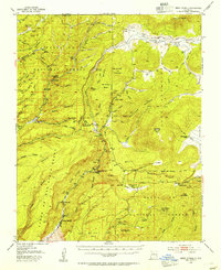
1952 · Jemez Springs
USGS Topo · 1:62,500