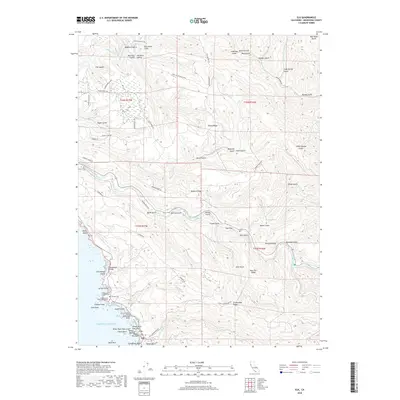
2018 Map of Elk
USGS Topo · Published 2018About this map
Elk sits prominently on the Mendocino coast in this 2018 survey, anchoring a landscape where the rugged Pacific shoreline meets the steep ridges of the California Coast Ranges. The coastal geography is defined by significant landmarks such as Cuffeys Cove Inlet and Newgard Bluff, while the interior is a complex network of drainages including the Navarro River and Albion River. The map provides a detailed view of local heritage sites, particularly at the northern edge of the settlement where the Cuffeys Cove Catholic Cem, Cuffeys Cove Community Cem, and Druids Cem are clustered.
Find a feature on this map
81 named features on this map. Tap any name to fly to it.
Don’t see what you’re looking for? This feature index may not catch every label — zoom into the map to look around manually.
Map Details
Editions of this 2018 Elk Map
This is the sole edition of this map. No revisions or reprints were ever made.
Other maps of this area

1920 · Glenblair
USGS Topo · 1:62,500

1920 · Fort Bragg
USGS Topo · 1:62,500

1943 · Glenblair
USGS Topo · 1:62,500

1943 · Fort Bragg
USGS Topo · 1:62,500

1943 · Albion
USGS Topo · 1:62,500

1943 · Navarro
USGS Topo · 1:62,500

1944 · Saddle Point
USGS Topo · 1:62,500

1957 · Ukiah
USGS Topo · 1:250,000

1960 · Ukiah
USGS Topo · 1:250,000
1960 · Elk
USGS Topo · 1:24,000