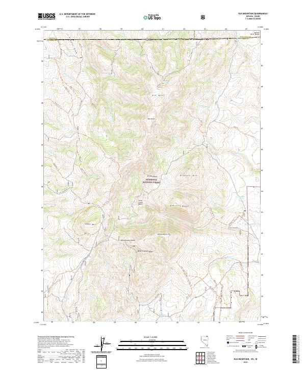
2021 Map of Elk Mountain
USGS Topo · Published 2021About this map
Humboldt National Forest dominates this high-altitude landscape along the Nevada-Idaho border, a region defined by complex drainage networks and volcanic-named relief. The terrain is structured by prominent summits such as Elk Mtn, Wrangle Mtn, and the distinctively named White Elephant Butte and Red Elephant Butte. This 2021 survey shows an extensive network of primitive paths, including the Ross 1 Trl and Bullcamp Trl, which navigate the steep canyons carved by Ross Pasture Cr and Axe Handle Cr. Isolated water sources like Chicken Spring and H Spring serve as critical landmarks in this arid environment. The map captures the meeting of several county and state lines, where Elko County joins Owyhee and Twin Falls counties, illustrating the jurisdictional boundaries that overlay these remote mountain basins.
Find a feature on this map
67 named features on this map. Tap any name to fly to it.
Don’t see what you’re looking for? This feature index may not catch every label — zoom into the map to look around manually.
Map Details
Editions of this 2021 Elk Mountain Map
This is the sole edition of this map. No revisions or reprints were ever made.
Other maps of this area

1955 · Twin Falls
USGS Topo · 1:250,000

1955 · Wells
USGS Topo · 1:250,000

1957 · Contact
USGS Topo · 1:62,500

1957 · Elk Mountain
USGS Topo · 1:62,500

1958 · Wells
USGS Topo · 1:250,000

1958 · Twin Falls
USGS Topo · 1:250,000

1961 · Wells
USGS Topo · 1:250,000

1978 · Taylor Canyon
USGS Topo · 1:24,000
1979 · Three Creek
USGS Topo · 1:24,000
1980 · Curtis Draw
USGS Topo · 1:24,000