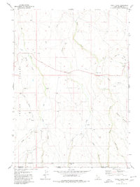
1979 Map of Three Creek
USGS Topo · Published 1980About this map
Three Creek lies at the heart of this high-desert landscape on the Idaho-Nevada border, where Owyhee County and Elko County meet. The settlement is centered around the Three Creek Sch, serving a community defined by vast range land and scattered water sources. The terrain is marked by distinct geological features such as Black Rock and Castle Rock, while naming conventions like Joiner Flat and Beaver Flat point to early ranching activity. A complex network of drainages, including Cherry Creek, Big Flat Creek, and Little Spring Creek, weaves through the Inside Desert. Human presence is further evidenced by a small Cem and several isolated wells and springs that would have been vital for livestock moving through Ross Pasture or toward the Corral identified in the south. The mapping of the state line between Idaho and Nevada underscores the area's role as a remote high-plateau borderland.
Find a feature on this map
34 named features on this map. Tap any name to fly to it.
Don’t see what you’re looking for? This feature index may not catch every label — zoom into the map to look around manually.
Map Details
Editions of this 1979 Three Creek Map
This is the sole edition of this map. No revisions or reprints were ever made.
Other maps of this area

1943 · Jarbidge
USGS Topo · 1:62,500

1945 · Jarbidge
USGS Topo · 1:62,500

1955 · Twin Falls
USGS Topo · 1:250,000

1955 · Wells
USGS Topo · 1:250,000

1957 · Elk Mountain
USGS Topo · 1:62,500

1958 · Wells
USGS Topo · 1:250,000

1958 · Twin Falls
USGS Topo · 1:250,000

1961 · Wells
USGS Topo · 1:250,000

1979 · Salls Crossing
USGS Topo · 1:24,000

1979 · Mosquito Lake Butte
USGS Topo · 1:24,000