
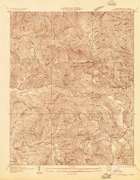
1934 Map of Elk Park
USGS Topo · Published 1934About this map
The Eastern Tennessee and Western North Carolina railroad corridor anchors this 1934 survey, tracing the high-country landscape where industrial mining and mountain education meet. In the south, the village of Cranberry serves as a hub near the Cranberry High Sch, while further east, the presence of Lees McRae Jr College and the Grandfather Orphanage at Banner Elk points to the area's established institutional history during the mid-depression era. The terrain is defined by the sharp descent of the Elk River and its numerous cascades, including Twisting Falls and Elk Falls. Local genealogy is well-represented through family-named landmarks and rural gathering places like Harperdale Ch and Buck Mtn School, illustrating a dispersed but connected mountain community linked by State Highway No 194 and the Linville River rail line.
Find a feature on this map
88 named features on this map. Tap any name to fly to it.
Don’t see what you’re looking for? This feature index may not catch every label — zoom into the map to look around manually.
Map Details
Editions of this 1934 Elk Park Map
This is the sole edition of this map. No revisions or reprints were ever made.
Other maps of this area

1891 · Roan Mountain
USGS Topo · 1:125,000

1893 · Cranberry
USGS Topo · 1:125,000

1894 · Roan Mountain
USGS Topo · 1:125,000

1895 · Cranberry
USGS Topo · 1:125,000

1899 · Cranberry
USGS Topo · 1:125,000

1902 · Cranberry
USGS Topo · 1:125,000

1904 · Roan Mountain
USGS Topo · 1:125,000

1934 · Valle Crucis
USGS Topo · 1:24,000

1934 · White Rocks Mtn
USGS Topo · 1:24,000
1934 · Carvers Gap
USGS Topo · 1:24,000