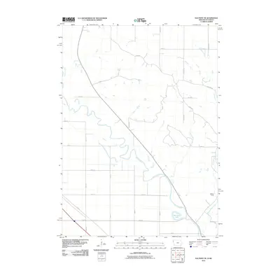
2010 Map of Elk Point NE
USGS Topo · Published 2010About this map
The Big Sioux River meanders across this prairie landscape at the border of Iowa and South Dakota, defining the character of the terrain. The settlement of Broken Kettle stands as a focal point in the southeast, situated near where Broken Kettle Creek joins the larger river system. This area is characterized by its agricultural grid, where roads like Butcher Rd and N Ridge Rd cut across the drainage basins of Rock Creek and Joy Creek. A prominent oxbow feature, Horseshoe Lake, indicates the historical movement of the river channel, a common sight in this floodplain environment. For those interested in regional hydrology or local land use, the map provides a clear look at how the natural drainage of Deer Creek and other tributaries interacts with the rural road network in Union and Plymouth counties.
Find a feature on this map
28 named features on this map. Tap any name to fly to it.
Don’t see what you’re looking for? This feature index may not catch every label — zoom into the map to look around manually.
Map Details
Editions of this 2010 Elk Point NE Map
This is the sole edition of this map. No revisions or reprints were ever made.
Other maps of this area

1898 · Elk Point
USGS Topo · 1:125,000

1901 · Elk Point
USGS Topo · 1:125,000

1907 · Elk Point
USGS Topo · 1:125,000

1955 · Sioux City
USGS Topo · 1:250,000

1958 · Sioux City
USGS Topo · 1:250,000

1959 · Sioux City
USGS Topo · 1:250,000

1963 · Elk Point
USGS Topo · 1:24,000

1963 · Sioux City North
USGS Topo · 1:24,000

1963 · Elk Point NE
USGS Topo · 1:24,000

1963 · Jefferson
USGS Topo · 1:24,000
Featured Places
- Elk Point Township, SD
- Civil Bend Township, SD
- Jefferson Township, SD
- Plymouth County, IA
- Union County, SD