
1963 Map of Elk Point NE
USGS Topo · Published 1964About this map
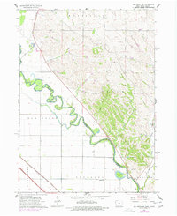
The Big Sioux River winds through the heart of this early 1960s survey, marking the serpentine border between Plymouth County, Iowa, and Union County, South Dakota. The dramatic oxbows of the river dominate the lowlands of Elk Point, while the upland topography to the east is dissected by Cook Creek and Deer Creek. This landscape reflects a mid-century agricultural and industrial pattern, where the Chicago Milwaukee St Paul and Pacific railroad corridor runs parallel to localized extraction sites like the Gravel Pits and Shale Pit. Educational and community anchors are well-documented for genealogists, including Gill Sch, Fieldview Sch, and Murphy Sch. The southern portion of the map is defined by the distinct townships of Jefferson and Hancock, featuring the prominent Horseshoe Lake near the river’s edge.
Find a feature on this map
18 named features on this map. Tap any name to fly to it.
Don’t see what you’re looking for? This feature index may not catch every label — zoom into the map to look around manually.
Map Details
Editions of this 1963 Elk Point NE Map
2 editions found
Other maps of this area

1898 · Elk Point
USGS Topo · 1:125,000

1901 · Elk Point
USGS Topo · 1:125,000

1907 · Elk Point
USGS Topo · 1:125,000

1955 · Sioux City
USGS Topo · 1:250,000

1958 · Sioux City
USGS Topo · 1:250,000

1959 · Sioux City
USGS Topo · 1:250,000

1963 · Elk Point
USGS Topo · 1:24,000

1963 · Sioux City North
USGS Topo · 1:24,000

1963 · Jefferson
USGS Topo · 1:24,000
1964 · Ponca
USGS Topo · 1:24,000
Featured Places
- Jefferson Township, SD
- Elk Point Township, SD
- Civil Bend Township, SD
- Plymouth County, IA
- Union County, SD