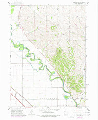
1963 Map of Elk Point NE
USGS Topo · Published 1977About this map
The Big Sioux River creates a meandering natural border between Iowa and South Dakota, carving deep oxbows and loops across the landscape. Along the Iowa side, the Chicago Milwaukee St Paul and Pacific railroad tracks parallel the water, serving the agricultural and industrial needs of Plymouth County. The map reveals a rural infrastructure defined by scattered landmarks like the Murphy Sch in Jefferson and several extraction sites including Gravel Pits and a Shale Pit. The complex hydrology of the river valley is evidenced by Horseshoe Lake, a remnant of the river's shifting course, while smaller tributaries such as Deer Creek and Rock Creek drain the surrounding uplands of Westfield and Sioux.
Find a feature on this map
16 named features on this map. Tap any name to fly to it.
Don’t see what you’re looking for? This feature index may not catch every label — zoom into the map to look around manually.
Map Details
Editions of this 1963 Elk Point NE Map
2 editions found
Other maps of this area

1898 · Elk Point
USGS Topo · 1:125,000

1901 · Elk Point
USGS Topo · 1:125,000

1907 · Elk Point
USGS Topo · 1:125,000

1955 · Sioux City
USGS Topo · 1:250,000

1958 · Sioux City
USGS Topo · 1:250,000

1959 · Sioux City
USGS Topo · 1:250,000

1963 · Elk Point
USGS Topo · 1:24,000

1963 · Sioux City North
USGS Topo · 1:24,000

1963 · Elk Point NE
USGS Topo · 1:24,000

1963 · Jefferson
USGS Topo · 1:24,000
Featured Places
- Jefferson Township, SD
- Elk Point Township, SD
- Civil Bend Township, SD
- Plymouth County, IA
- Union County, SD