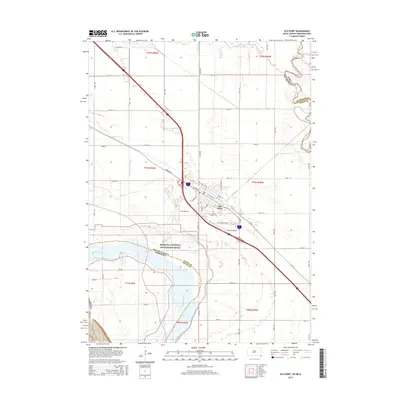
2015 Map of Elk Point
USGS Topo · Published 2015About this map
Elk Point serves as the focal point of this tri-state border region, situated where South Dakota, Iowa, and Nebraska converge. The landscape is defined by the shifting course of the Missouri River, specifically the protected corridor of the Missouri National Recreation River along the southern edge. The town's grid is detailed with street names like E Pleasant St and W Main St, and includes local landmarks such as Saint Joseph Cem.
Find a feature on this map
39 named features on this map. Tap any name to fly to it.
Don’t see what you’re looking for? This feature index may not catch every label — zoom into the map to look around manually.
Map Details
Editions of this 2015 Elk Point Map
This is the sole edition of this map. No revisions or reprints were ever made.
Other maps of this area

1898 · Elk Point
USGS Topo · 1:125,000

1901 · Elk Point
USGS Topo · 1:125,000

1907 · Elk Point
USGS Topo · 1:125,000

1955 · Sioux City
USGS Topo · 1:250,000

1958 · Sioux City
USGS Topo · 1:250,000

1959 · Sioux City
USGS Topo · 1:250,000

1963 · Elk Point
USGS Topo · 1:24,000

1963 · Elk Point NE
USGS Topo · 1:24,000

1963 · Jefferson
USGS Topo · 1:24,000

1964 · Burbank
USGS Topo · 1:24,000