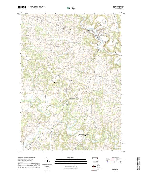
2022 Map of Elkader
USGS Topo · Published 2022About this map
The Clayton County Courthouse anchors the settlement of Elkader, where the Turkey River winds through the driftless-like terrain of northeast Iowa. This modern topographic survey illustrates a landscape deeply connected to its pioneers and natural contours, from the elevations of Chicken Ridge to the winding course of the Volga River. The map is particularly rich for genealogical research, documenting numerous family and community burial grounds including Saint Josephs Cem, Hartmann Cem, and Schmidt Cem. Small hamlets and former points of commerce like Osborne and Mederville are preserved in their contemporary context, alongside local landmarks like the Elkader Airport. The intricate road network, featuring names like Strawberry Point Rd and Chariot Rd, follows the ridges and valleys of French Hollow, revealing the enduring spatial organization of this river-valley community.
Find a feature on this map
79 named features on this map. Tap any name to fly to it.
Don’t see what you’re looking for? This feature index may not catch every label — zoom into the map to look around manually.
Map Details
Editions of this 2022 Elkader Map
This is the sole edition of this map. No revisions or reprints were ever made.
Historical Maps of Elkader Through Time
3 maps found