1902 Map of Elkader
USGS Topo · Published 1949About this map
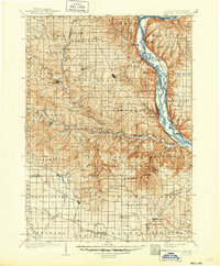
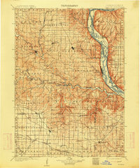
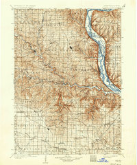
Elkader serves as the focal point of this northeast Iowa landscape, situated along the winding course of the Turkey River. Surveyed in the final years of the 19th century, the map reveals a well-established network of river towns and railroad depots. The Mississippi River forms a dominant eastern boundary, where the Chicago Burlington and Northern RR follows the shoreline through Glen Haven and Cassville. Inland, the Volga River and its tributary Cox Creek cut through the terrain, supporting small settlements like Volga and Communia.
Find a feature on this map
104 named features on this map. Tap any name to fly to it.
Don’t see what you’re looking for? This feature index may not catch every label — zoom into the map to look around manually.
Map Details
Editions of this 1902 Elkader Map
4 editions found
Other maps of this area

1900 · Anamosa
USGS Topo · 1:125,000

1900 · Lancaster
USGS Topo · 1:125,000

1901 · Peosta
USGS Topo · 1:125,000

1901 · Oelwein
USGS Topo · 1:125,000

1902 · Elkader
USGS Topo · 1:125,000

1903 · Waukon
USGS Topo · 1:125,000

1903 · Winthrop
USGS Topo · 1:125,000

1904 · Lancaster
USGS Topo · 1:125,000

1906 · Decorah
USGS Topo · 1:125,000

1908 · Lancaster
USGS Topo · 1:125,000