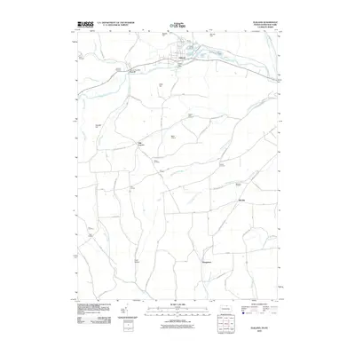
2010 Map of Elkland
USGS Topo · Published 2010About this map
The Cowanesque River corridor anchors this Tioga County landscape, defining the layout of historic borough centers and rural crossroads at the start of the 21st century. Elkland and Osceola sit along the northern bank, maintaining their established grid patterns and community hubs like the Elkland Post Office. To the south, the terrain transitions into a network of creek valleys and high ridges, where smaller named points such as Odle Corners, Shinglebury, and Croft Hollow mark the intersections of the winding rural road system.
Find a feature on this map
55 named features on this map. Tap any name to fly to it.
Don’t see what you’re looking for? This feature index may not catch every label — zoom into the map to look around manually.
Map Details
Editions of this 2010 Elkland Map
This is the sole edition of this map. No revisions or reprints were ever made.
Other maps of this area

1900 · Tioga
USGS Topo · 1:62,500

1900 · Elkland
USGS Topo · 1:62,500

1902 · Tioga
USGS Topo · 1:62,500

1914 · Corning
USGS Topo · 1:62,500

1924 · Woodhull
USGS Topo · 1:48,000

1926 · Woodhull
USGS Topo · 1:62,500

1944 · Woodhull
USGS Topo · 1:62,500

1944 · Corning
USGS Topo · 1:62,500

1950 · Elmira
USGS Topo · 1:250,000

1953 · Woodhull
USGS Topo · 1:24,000