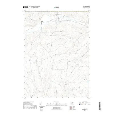
2019 Map of Elkland
USGS Topo · Published 2019About this map
The Cowanesque River valley forms the primary axis of this Tioga County survey, where the borough of Elkland sits at the northern edge along the border between Pennsylvania and New York. The landscape transitions from the river flats to high ridges such as Briar Hill and Windfall Hill, which are incised by numerous drainages like Holden Cr and Thornbottom Cr. A dense network of rural roads and cemeteries defines the upland areas, suggesting a long history of family homesteads and small communities like Osceola and Elbridge. Many of these burial grounds, including Peters Cem, Highland Cem, and Mourey Cem, are situated on high ground overlooking the creek valleys. Near the center of the sheet, the Baker Airport occupies a flat plateau on Briar Hill, providing a modern landmark amidst the older patterns of rural settlement and agriculture that continue to shape the terrain.
Find a feature on this map
87 named features on this map. Tap any name to fly to it.
Don’t see what you’re looking for? This feature index may not catch every label — zoom into the map to look around manually.
Map Details
Editions of this 2019 Elkland Map
This is the sole edition of this map. No revisions or reprints were ever made.
Other maps of this area

1900 · Tioga
USGS Topo · 1:62,500

1900 · Elkland
USGS Topo · 1:62,500

1902 · Tioga
USGS Topo · 1:62,500

1914 · Corning
USGS Topo · 1:62,500

1924 · Woodhull
USGS Topo · 1:48,000

1926 · Woodhull
USGS Topo · 1:62,500

1944 · Woodhull
USGS Topo · 1:62,500

1944 · Corning
USGS Topo · 1:62,500

1950 · Elmira
USGS Topo · 1:250,000

1953 · Woodhull
USGS Topo · 1:24,000