2024 Map of Elkville
USGS Topo · Published 2024About this map
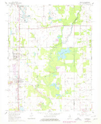
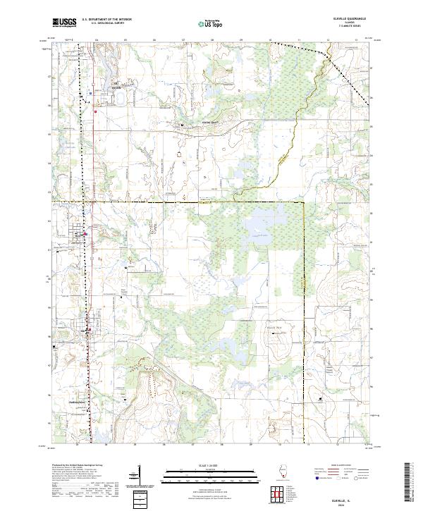
The Little Muddy River meanders through this portion of Southern Illinois, forming a natural boundary as it flows past the elevated terrain of Dutch Hill. The landscape is a mix of agricultural fields and water features, including the significant waters of Campbell Lake and Fox Lake. This area is characterized by a high density of small family and community burial grounds, such as Gill Cem, Davis Number 1 Cem, and Osage Cem, which provide essential points of reference for genealogical research. The settlement pattern is anchored by Elkville and Dowell in the south, while Du Quoin and the original site of Old Du Quoin mark the northern reaches. The CN railroad corridor parallels the modern road network, connecting these historic mining and farming communities. Educational and recreational life is represented by the John A Logan College DuQuoin Extension Center and the Security Club Lake.
Find a feature on this map
117 named features on this map. Tap any name to fly to it.
Don’t see what you’re looking for? This feature index may not catch every label — zoom into the map to look around manually.
Map Details
Editions of this 2024 Elkville Map
This is the sole edition of this map. No revisions or reprints were ever made.