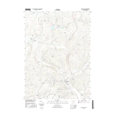
2016 Map of Ellicottville
USGS Topo · Published 2016About this map
The village of Ellicottville serves as the focal point of this 2016 survey, situated where Plum Cr joins Great Valley Creek. This high-elevation terrain in Cattaraugus County is defined by a series of prominent peaks and ridges including Jackman Hill, Poverty Hill, and McCarty Hill. The landscape reflects a modern transition toward recreation and tourism, evidenced by the presence of the Holimont XC Ski Trail and the KC Trail winding through the southwestern uplands. Small rural hamlets and crossroads like Maples, Plato, and Orlando are connected by a network of winding roads such as Hinman Hollow Rd and Tough Row Rd. Genealogists will find several burial sites preserved across the hills, from the Holy Cross Cem near the village to the more isolated Bowen Cem and Maples Cem in the outlying valleys.
Find a feature on this map
105 named features on this map. Tap any name to fly to it.
Don’t see what you’re looking for? This feature index may not catch every label — zoom into the map to look around manually.
Map Details
Editions of this 2016 Ellicottville Map
This is the sole edition of this map. No revisions or reprints were ever made.
Other maps of this area

1900 · Salamanca
USGS Topo · 1:62,500

1922 · Randolph
USGS Topo · 1:62,500

1923 · Randolph
USGS Topo · 1:62,500

1923 · Cattaraugus
USGS Topo · 1:62,500

1924 · Ellicottville
USGS Topo · 1:62,500

1938 · Cattaraugus
USGS Topo · 1:62,500

1938 · Salamanca
USGS Topo · 1:62,500

1941 · Cattaraugus
USGS Topo · 1:62,500

1941 · Ellicottville
USGS Topo · 1:62,500

1943 · Randolph
USGS Topo · 1:62,500