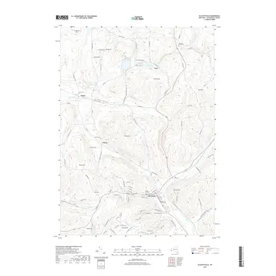
2019 Map of Ellicottville
USGS Topo · Published 2019About this map
Ellicottville serves as the focal point for this landscape, where the confluence of Great Valley Creek and Plum Creek shapes the local valley floor. The map highlights a community deeply connected to its upland terrain, with numerous named heights including Jackman Hill, McCarty Hill, and Poverty Hill framing the lowlands. This modern survey illustrates the importance of the local recreation economy, featuring the extensive Holiday Valley resort and the Holimont XC Ski Trail, which occupy the slopes south of the village. Smaller, historic clusters such as Maples, Plato, and Orlando are still identifiable, often anchored by local landmarks like Maples Cem or Saint Pauls Lutheran Cem. Significant water features like Mansfield Creek and Beaver Meadows Creek drain the surrounding hills, while Stoney Pitcher Falls provides a specific natural landmark in the northwest reaches of the township.
Find a feature on this map
97 named features on this map. Tap any name to fly to it.
Don’t see what you’re looking for? This feature index may not catch every label — zoom into the map to look around manually.
Map Details
Editions of this 2019 Ellicottville Map
This is the sole edition of this map. No revisions or reprints were ever made.
Other maps of this area

1900 · Salamanca
USGS Topo · 1:62,500

1922 · Randolph
USGS Topo · 1:62,500

1923 · Randolph
USGS Topo · 1:62,500

1923 · Cattaraugus
USGS Topo · 1:62,500

1924 · Ellicottville
USGS Topo · 1:62,500

1938 · Cattaraugus
USGS Topo · 1:62,500

1938 · Salamanca
USGS Topo · 1:62,500

1941 · Cattaraugus
USGS Topo · 1:62,500

1941 · Ellicottville
USGS Topo · 1:62,500

1943 · Randolph
USGS Topo · 1:62,500