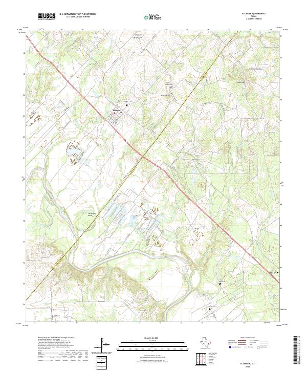
2022 Map of Ellinger
USGS Topo · Published 2022About this map
Colorado River frontage and the winding path of Brushy Cr define the landscape south of Ellinger. This area, situated along the Fayette and Colorado County line, is characterized by a high density of rural burial sites that reflect the region's cultural history, including the Ross Prairie Lutheran Church Cem and the Cesko Narodni Hrbitov Cem. Near Live Oak Hill, the terrain is marked by significant elevation changes such as Rocky Hill, while the river south of town carves the distinctive Horseshoe Bend. The road network connects small family-named landmarks and old routes like Burnham Ferry Rd, showing the continued importance of early transport paths in this part of Texas. From Crier Cr to the various branches like Flinder Br and Snyder Br, the drainage patterns provide a clear look at the area's physical geography.
Find a feature on this map
74 named features on this map. Tap any name to fly to it.
Don’t see what you’re looking for? This feature index may not catch every label — zoom into the map to look around manually.
Map Details
Editions of this 2022 Ellinger Map
This is the sole edition of this map. No revisions or reprints were ever made.
Other maps of this area

1919 · Fayettsville
USGS Topo · 1:62,500

1919 · Schulenburg
USGS Topo · 1:62,500

1953 · Seguin
USGS Topo · 1:250,000

1956 · Glidden
USGS Topo · 1:62,500

1956 · La Grange
USGS Topo · 1:62,500

1957 · Ellinger
USGS Topo · 1:24,000

1957 · La Grange East
USGS Topo · 1:24,000

1957 · Columbus
USGS Topo · 1:24,000

1957 · Borden
USGS Topo · 1:24,000

1957 · Ammannsville
USGS Topo · 1:24,000