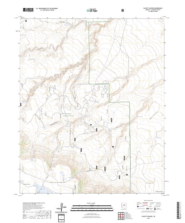
2023 Map of Elliott Canyon
USGS Topo · Published 2023About this map
Anderson Mesa dominates the southern landscape of this high-elevation terrain within the Coconino National Forest. The region is defined by an intricate network of drainage systems, including Mormon Canyon, Elliott Canyon, and the appropriately named Yellow Jacket Canyon. This 2023 survey illustrates a landscape heavily managed for water resources in an arid environment, characterized by numerous catchment basins such as Purple Tank, Buzzard Tank, and Boundary Tank. These features, alongside Long Lake and Indian Lake, reveal the critical infrastructure required for ranching or wildlife management on the mesa. Perennial water sources like Yellow Jacket Spring and Billy Back Spring provide vital points of interest for those tracing the historical geography of Coconino County, while the transition from mesas to deep draws like Wagon Box Draw highlights the complex topography of the Mogollon Rim country.
Find a feature on this map
33 named features on this map. Tap any name to fly to it.
Don’t see what you’re looking for? This feature index may not catch every label — zoom into the map to look around manually.
Map Details
Editions of this 2023 Elliott Canyon Map
This is the sole edition of this map. No revisions or reprints were ever made.
Other maps of this area

1886 · San Francisco Mtns
USGS Topo · 1:250,000

1887 · Verde
USGS Topo · 1:250,000

1891 · San Francisco Mtns
USGS Topo · 1:250,000

1892 · Verde
USGS Topo · 1:250,000

1894 · San Francisco Mtns
USGS Topo · 1:250,000

1899 · San Francisco Mtns
USGS Topo · 1:250,000

1947 · Flagstaff
USGS Topo · 1:250,000

1954 · Flagstaff
USGS Topo · 1:250,000

1954 · Holbrook
USGS Topo · 1:250,000

1957 · Holbrook
USGS Topo · 1:250,000