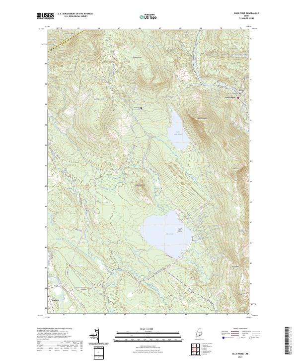
2024 Map of Ellis Pond
USGS Topo · Published 2024About this map
Byron and Andover anchor this modern topographic survey of western Maine, where the Swift River and its East Branch carve through the high elevations of the Oxford and Franklin County line. The settlement pattern remains concentrated along river valleys and the shores of Ellis Pond, which features the prominent French Island. Genealogists will find several small burial grounds documented, including Byron Village Cem, Stockbridge Cem, and Pressey Cem, often located near historical roads like Byron Rd.
Find a feature on this map
54 named features on this map. Tap any name to fly to it.
Don’t see what you’re looking for? This feature index may not catch every label — zoom into the map to look around manually.
Map Details
Editions of this 2024 Ellis Pond Map
This is the sole edition of this map. No revisions or reprints were ever made.
Other maps of this area

1927 · Rumford
USGS Topo · 1:48,000

1930 · Rumford
USGS Topo · 1:62,500

1933 · Rangeley
USGS Topo · 1:48,000

1939 · Rangeley
USGS Topo · 1:62,500

1940 · Oquossoc
USGS Topo · 1:62,500

1942 · Oquossoc
USGS Topo · 1:62,500

1943 · Old Speck Mtn
USGS Topo · 1:62,500

1945 · Old Speck Mtn
USGS Topo · 1:62,500

1949 · Rangeley
USGS Topo · 1:62,500

1950 · Lewiston
USGS Topo · 1:250,000