2021 Map of Ellsinore
USGS Topo · Published 2021About this map
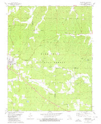
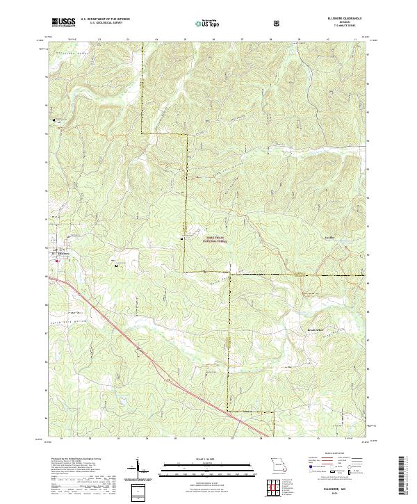
The town of Ellsinore sits at the southwestern edge of this landscape, positioned where State Hwy V and State Hwy A meet amidst the rolling woodlands of the Mark Twain National Forest. The map reveals a dispersed settlement pattern typical of the eastern Ozarks, where small communities like Upalika and Brush Arbor are connected by a network of hollows and ridges. Waterways such as Cane Creek and Little Brushy Cr carve through the terrain, defining the local geography alongside family-named features like Condrays Lake and Kelly Ridge. Genealogists will find significant value in the documentation of numerous local burial grounds, including Henson Cem and Kearney Cem, as well as the location of the Lone Star School, which serves as a landmark of the area's rural educational history.
Find a feature on this map
36 named features on this map. Tap any name to fly to it.
Don’t see what you’re looking for? This feature index may not catch every label — zoom into the map to look around manually.
Map Details
Editions of this 2021 Ellsinore Map
This is the sole edition of this map. No revisions or reprints were ever made.