2024 Map of Elsah
USGS Topo · Published 2024About this map
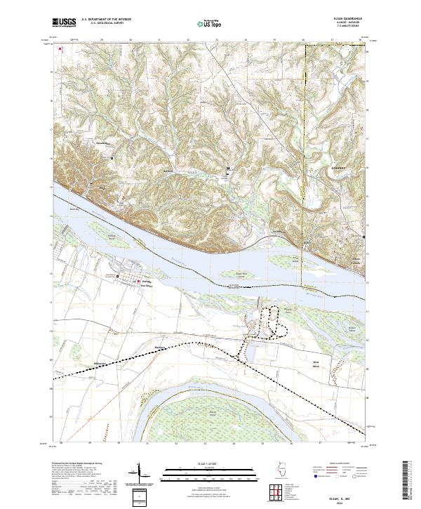
Principia College overlooks the Mississippi River bluffs above Elsah, an area where the dramatic river landscape dictates the layout of local settlements. This contemporary survey details the complex confluence region where the Missouri River approaches the Mississippi, creating a low-lying floodplain populated by islands such as Pelican Island, Portage Island, and Dresser Island. The geography of the riverbanks is preserved within the Two Rivers National Wildlife Refuge, while the upland areas in Jersey County are marked by a network of winding roads and established cemeteries like Wendle Cem and Saint Michaels Cem. Settlement patterns on the Missouri side, including Portage Des Sioux and West Alton, show the enduring grid of river-town life nestled within the Brick House Slough and Poeling Lake drainage systems.
Find a feature on this map
122 named features on this map. Tap any name to fly to it.
Don’t see what you’re looking for? This feature index may not catch every label — zoom into the map to look around manually.
Map Details
Editions of this 2024 Elsah Map
This is the sole edition of this map. No revisions or reprints were ever made.