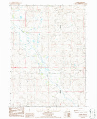
1986 Map of Elsmere
USGS Topo · Published 1986About this map
Elsmere sits at the heart of this mid-1980s topographical study, a remote ranching settlement situated where the winding course of Goose Creek cuts through the Sandhills. The landscape is defined by its hydrology, specifically the numerous Flowing Wells and individual Wells that suggest a high water table critical for livestock in this arid region of the Nebraska panhandle. Straddling the boundary of Cherry County and Brown County, the map captures the vast, open character of the high plains, where man-made infrastructure is limited to occasional ranch tracks, section lines, and a lone Transmission Line cutting across the southern reaches. The placement of wells throughout the township lines indicates a reliance on groundwater to support the sparse population and agricultural life of the era.
Find a feature on this map
8 named features on this map. Tap any name to fly to it.
Don’t see what you’re looking for? This feature index may not catch every label — zoom into the map to look around manually.
Map Details
Editions of this 1986 Elsmere Map
This is the sole edition of this map. No revisions or reprints were ever made.
Other maps of this area

1949 · Purdum
USGS Topo · 1:62,500

1949 · Koshopah
USGS Topo · 1:62,500

1949 · Long Lake
USGS Topo · 1:62,500

1951 · Long Lake
USGS Topo · 1:62,500

1951 · Purdum
USGS Topo · 1:62,500

1951 · Moon Lake
USGS Topo · 1:62,500

1951 · Koshopah
USGS Topo · 1:62,500

1957 · Valentine
USGS Topo · 1:250,000

1959 · Valentine
USGS Topo · 1:250,000
1985 · Long Lake SE
USGS Topo · 1:24,000