Old Maps of Cherry County, Nebraska
Explore 703 old maps of Cherry County, spanning from 1948 to today. These high-resolution historic maps reveal how streets, neighborhoods, landmarks, and natural features evolved over time — perfect for genealogy, metal detecting, research, and local history exploration.
What you can do with these maps:
- See how Cherry County changed over time: Compare historical maps to modern-day views to trace roads, homesites, rail lines & more.
- View detailed metadata: Each map includes creators, publishers, year, scale, and archive source.
- Overlay maps with satellite & LiDAR: Visualize the past alongside modern tools to explore terrain & human change.
- Trusted historical sources: Maps sourced from the USGS, Library of Congress, and other archives.
- Access maps your way: View online, download high-res files, or order prints for personal or research use.
Start exploring old maps of Cherry County to uncover forgotten places, hidden landmarks, and the deep history beneath your feet.
Cherry County, NE maps
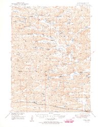
(703)- 1948 Map of Seneca, 1956 Print
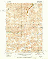
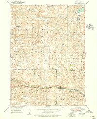 1948 Seneca1956 Print · USGSThe Middle Loup River valley in the late 1940s served as a lifeline for ranching and rail. Genealogists can trace family-named landmarks like Phillips Ranch and Simonson and Lowe Ranch or locate the old Virginia Sch.3 unique versions available
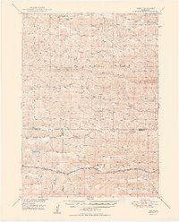
 - 1948 Map of Ashby, 1960 Print
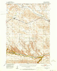
 1948 Ashby1960 Print · USGSRanching life in the Nebraska Sandhills is captured here in the late 1940s, highlighting the sprawling cattle operations and alkaline lake systems of the era. Genealogists and historians can trace family holdings like the Egan Ranch or locate the Consolidated Sch and Keller Sch along the Chicago Burlington and Quincy RR.7 unique versions available
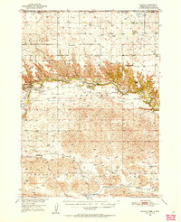
 - 1948 Map of Bingham, 1963 Print
 1948 Bingham1963 Print · USGSThe Nebraska Sandhills come into sharp focus in the late 1940s, showing a remote ranching landscape defined by its many lakes and isolated schoolhouses. Genealogists can locate family landmarks like Lambert Ranch, the rail stop at Bingham, and rural sites like Burton Sch.2 unique versions available
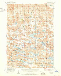
 - 1948 Map of Mullen, 1967 Print
 1948 Mullen1967 Print · USGSMullen and the surrounding Sandhills are captured in the late 1940s, showing a landscape shaped by ranching and the Chicago Burlington and Quincy line. Trace early schools and settlements like Hecla, Cherry Sch, and Reigle Sch.
 - 1948 Map of Seneca 4, 1974 Print
 1948 Seneca 41974 Print · USGSThe Nebraska Sand Hills and the Cherry County border come to life in the late 1940s, showing the intersection of rail transit and rural ranching. Genealogists can trace family roots through the locations of Eatinger Sch, School No 9, and the settlement at Norway.
 - 1948 Map of Spade Ranch, 1976 Print
 1948 Spade Ranch1976 Print · USGSSheridan and Cherry counties are shown in the late 1940s, a period defined by the isolated ranching life of the Nebraska Sandhills. Researchers can trace the footprint of rural education and ranching at Spade Ranch, Argo, and numerous one-room schoolhouses like School No 166.
 - 1948 Map of Whitman, 1978 Print
 1948 Whitman1978 Print · USGSCherry County ranching and rail life are at the forefront of this mid-century survey of the Nebraska Sandhills. Researchers can trace family ranch boundaries like Monahan and Rothwell, or locate rural landmarks like the Red Mill School.
 - 1949 Map of Seneca 4
 1949 Seneca 41949 Print · USGSThe Nebraska Sandhills in the late 1940s reveal a landscape of isolated ranching outposts and river-valley transport. Genealogists and local historians can trace the foundations of rural life through Eatinger Sch, the settlement of Norway, and the Middle Loup River rail corridor.
 - 1949 Map of Ashby
 1949 Ashby1949 Print · USGSPost-war Nebraska ranching life and the Sandhills topography come alive in this survey of the Cherry and Grant county lines. Trace old homesteads and landmarks like the Diamond Bar Ranch, the Consolidated Sch, and Wolfenberger Lakes along the Chicago Burlington and Quincy line.3 unique versions available
 - 1949 Map of Big Falls, 1963 Print
 1949 Big Falls1963 Print · USGSCherry County ranching life is frozen in time at mid-century, before modern consolidation changed the Nebraska Sandhills. Genealogists can trace family legacies at the Wolfenden Ranch, Sherman Ranch, and rural schoolhouses like Starr Sch.
 - 1949 Map of Purdum, 1967 Print
 1949 Purdum1967 Print · USGSThe Nebraska Sandhills come into focus in the late 1940s as a region of remote ranching outposts and high prairie rivers. Researchers can locate dozens of historic family lands like the McMullen Ranch and Atkinson Ranch, or trace the rural school system through West Purdum Sch and Compton Sch.
 - 1949 Map of Steverson Lake, 1969 Print
 1949 Steverson Lake1969 Print · USGSThe Nebraska Sandhills come alive in this post-war ranching survey of Cherry County, showing a landscape defined by water and wide-open grazing lands. Genealogists can trace family holdings like Metzger Ranch and Wright Ranch or locate old schoolhouses such as School No 170.
 - 1949 Map of Koshopah, 1976 Print
 1949 Koshopah1976 Print · USGSThe Nebraska Sandhills ranching country is captured here during the post-war era, showing the intersection of three counties. Genealogists can trace family holdings and local landmarks like White Ranch, Koshopah, and the many rural schools including Pixley Sch.
 - 1949 Map of Turpin Lake, 1976 Print
 1949 Turpin Lake1976 Print · USGSCherry County cattle country is shown here in the late 1940s, a period when the Nebraska Sandhills were dotted with family-run ranches and isolated prairie schools. Genealogists can locate family holdings like Beckwith Ranch and Keller Ranch or trace the remote Gordon Valley Ch.
 - 1949 Map of Long Lake, 1978 Print
 1949 Long Lake1978 Print · USGSIn the Nebraska Sandhills during the late 1940s, ranching life followed the winding path of Goose Creek and the lake-filled basins of the north. Genealogists can trace family homesteads like Schleuter Ranch, Gudgel Ranch, and the Hartgraves Place.
 - 1950 Map of Norden
 1950 Norden1950 Print · USGSThe Niobrara River valley in the early fifties shows a rugged landscape of family-run cattle operations and scattered rural school districts. Genealogists can locate family holdings like Worth Ranch or McMara Ranch and burial sites at Sparks Cem.2 unique versions available
 - 1950 Map of Whitman
 1950 Whitman1950 Print · USGSMid-century Cherry County ranching culture is preserved here just as the post-war era was reshaping the Nebraska Sandhills. Genealogists and historians can trace the vast Rothwell Ranch, find the rural Red Mill School, and follow the Chicago Burlington and Quincy rail line.
 - 1950 Map of Spade Ranch
 1950 Spade Ranch1950 Print · USGSThe Nebraska Sandhills come into sharp focus mid-century, detailing a region of remote cattle ranching and high plains hydrology. Genealogists and historians can trace the network of rural schoolhouses and family-named landmarks like Spade Ranch, Hill Crest Sch, and McAlister Lake.2 unique versions available
 - 1950 Map of Hire
 1950 Hire1950 Print · USGSThe Nebraska Sandhills come into focus in the early fifties, where the Loup River branches converge at the Cherry and Hooker county lines. Genealogists can locate rural institutions like Cox Sch and the siding at Weir along the Chicago Burlington and Quincy rail line.3 unique versions available
 - 1950 Map of Bingham
 1950 Bingham1950 Print · USGSBingham and the surrounding ranchlands of Sheridan County are shown here in the mid-twentieth century as the railroad still anchored the Sandhills economy. Genealogists and local historians can trace family-named landmarks like Lambert Ranch and isolated rural schoolhouses including School No 156.
 - 1950 Map of Sparks, 1952 Print
 1950 Sparks1952 Print · USGSThe Niobrara River canyon cuts through Cherry County during the mid-twentieth century, revealing a landscape of remote ranches and conservation lands. Researchers can trace the Chicago and North Western rail line and locate rural landmarks like Smith Falls, Bryant Ranch, and several numbered schoolhouses.3 unique versions available
 - 1950 Map of Simeon, 1952 Print
 1950 Simeon1952 Print · USGSCherry County ranchlands and lake systems are documented here in the early post-war era, showing a remote landscape of sandhills and wetlands. Genealogists can locate named homesteads like Miller Ranch and Baker Ranch alongside rural outposts including Simeon PO and Duck Lake Sch.2 unique versions available
 - 1950 Map of Powderhorn Valley, 1952 Print
 1950 Powderhorn Valley1952 Print · USGSThe Nebraska Sandhills come alive in the mid-fifties, showing a landscape of sprawling ranch lands and essential river crossings. Genealogists and local historians can trace legacy holdings like Diamond Bar Ranch, find School No 167, or locate the Lampon Cem.
 - 1950 Map of Kennedy, 1952 Print
 1950 Kennedy1952 Print · USGSMid-century Nebraska ranching country comes alive in this survey of Cherry County during the early fifties. Genealogists and local historians can locate remote outposts like Arnold Camp, Burge, and family operations like Piercy Ranch.2 unique versions available
 - 1950 Map of Kilgore, 1952 Print
 1950 Kilgore1952 Print · USGSSettled along the tracks of the Chicago and North Western, this northern Nebraska landscape is shown at the mid-century point. Genealogists can trace rural family life through scattered schools like School No 10 and prominent sites like Dittmer Ranch.2 unique versions available
Showing maps 1-25 of 703
Top cities of Cherry County
- Valentine historical maps
- Cody historical maps
- Merriman historical maps
- Kilgore historical maps
- Crookston historical maps
- Wood Lake historical maps
See more
Frequently asked questions
- What are the different types of historical maps available for Cherry County?
- What is the oldest map of Cherry County?
- Where can I purchase historical maps of Cherry County for my home or office?
- Where can I download high-res historical maps of Cherry County?
- Are there historical topographic maps available for Cherry County?
- Is there historical aerial imagery available for Cherry County?
- Where are historical maps of Cherry County sourced from?