1950s Maps of Cherry County, Nebraska
Explore 41 historic maps of Cherry County from the 1950s. These maps offer a rare glimpse into what life looked like during the 1950s — showing old roads, neighborhoods, homes, and landmarks that have changed or disappeared over time.
Whether you're researching your family's past, planning a metal detecting trip, or studying how Cherry County's landscape evolved across the 1950s, these high-resolution maps are a powerful tool for exploring the history of this region.
- Focus on a specific era: All maps on this page are from the 1950s, giving you a focused view of this time period.
- See what’s changed: Compare century-old streets, trails, and buildings to today's modern landscape using overlays and satellite layers.
- Research with precision: Use these maps for genealogy, historical research, land use analysis, or educational projects.
- View, download, or print: Maps are fully viewable online in high resolution, and can be downloaded or printed for your own records.
Start exploring Cherry County's history through authentic maps from the 1950s. This is your window into the past.
Cherry County, NE maps
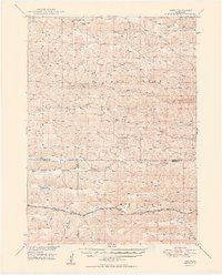
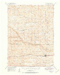
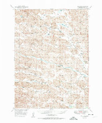
(41)- 1950 Map of Norden
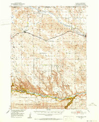
 1950 Norden1950 Print · USGSThe Niobrara River valley in the early fifties shows a rugged landscape of family-run cattle operations and scattered rural school districts. Genealogists can locate family holdings like Worth Ranch or McMara Ranch and burial sites at Sparks Cem.2 unique versions available
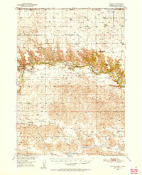
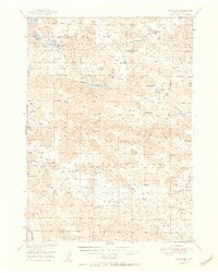
 - 1950 Map of Whitman
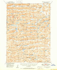
 1950 Whitman1950 Print · USGSMid-century Cherry County ranching culture is preserved here just as the post-war era was reshaping the Nebraska Sandhills. Genealogists and historians can trace the vast Rothwell Ranch, find the rural Red Mill School, and follow the Chicago Burlington and Quincy rail line.
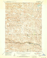
 - 1950 Map of Spade Ranch
 1950 Spade Ranch1950 Print · USGSThe Nebraska Sandhills come into sharp focus mid-century, detailing a region of remote cattle ranching and high plains hydrology. Genealogists and historians can trace the network of rural schoolhouses and family-named landmarks like Spade Ranch, Hill Crest Sch, and McAlister Lake.2 unique versions available
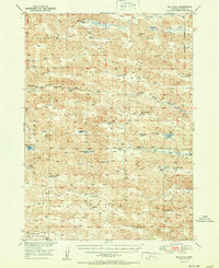
 - 1950 Map of Hire
 1950 Hire1950 Print · USGSThe Nebraska Sandhills come into focus in the early fifties, where the Loup River branches converge at the Cherry and Hooker county lines. Genealogists can locate rural institutions like Cox Sch and the siding at Weir along the Chicago Burlington and Quincy rail line.3 unique versions available
 - 1950 Map of Bingham
 1950 Bingham1950 Print · USGSBingham and the surrounding ranchlands of Sheridan County are shown here in the mid-twentieth century as the railroad still anchored the Sandhills economy. Genealogists and local historians can trace family-named landmarks like Lambert Ranch and isolated rural schoolhouses including School No 156.
 - 1950 Map of Sparks, 1952 Print
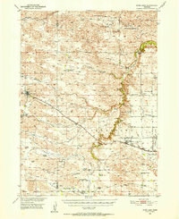
 1950 Sparks1952 Print · USGSThe Niobrara River canyon cuts through Cherry County during the mid-twentieth century, revealing a landscape of remote ranches and conservation lands. Researchers can trace the Chicago and North Western rail line and locate rural landmarks like Smith Falls, Bryant Ranch, and several numbered schoolhouses.3 unique versions available
 - 1950 Map of Simeon, 1952 Print
 1950 Simeon1952 Print · USGSCherry County ranchlands and lake systems are documented here in the early post-war era, showing a remote landscape of sandhills and wetlands. Genealogists can locate named homesteads like Miller Ranch and Baker Ranch alongside rural outposts including Simeon PO and Duck Lake Sch.2 unique versions available
 - 1950 Map of Powderhorn Valley, 1952 Print
 1950 Powderhorn Valley1952 Print · USGSThe Nebraska Sandhills come alive in the mid-fifties, showing a landscape of sprawling ranch lands and essential river crossings. Genealogists and local historians can trace legacy holdings like Diamond Bar Ranch, find School No 167, or locate the Lampon Cem.
 - 1950 Map of Kennedy, 1952 Print
 1950 Kennedy1952 Print · USGSMid-century Nebraska ranching country comes alive in this survey of Cherry County during the early fifties. Genealogists and local historians can locate remote outposts like Arnold Camp, Burge, and family operations like Piercy Ranch.2 unique versions available
 - 1950 Map of Kilgore, 1952 Print
 1950 Kilgore1952 Print · USGSSettled along the tracks of the Chicago and North Western, this northern Nebraska landscape is shown at the mid-century point. Genealogists can trace rural family life through scattered schools like School No 10 and prominent sites like Dittmer Ranch.2 unique versions available
 - 1950 Map of Wood Lake, 1952 Print
 1950 Wood Lake1952 Print · USGSThe Cherry County ranchlands come into focus at mid-century, where the Chicago and North Western railroad connects isolated Nebraska prairie towns. Genealogists and local historians can trace family-named estates like Shepard Ranch and Anderson Ranch or locate rural landmarks such as Woodlawn Cem and School No 84 North.2 unique versions available
 - 1950 Map of Arabia, 1952 Print
 1950 Arabia1952 Print · USGSCherry County ranching and rail life are preserved here at mid-century, centered on the Arabia railroad siding. Researchers can trace the legacy of early education and land use through numerous sites like School No 181, Rolling Stone Ranch, and Fairfield.
 - 1950 Map of Valentine, 1952 Print
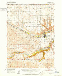 1950 Valentine1952 Print · USGSThe ranching and rail country of Cherry County comes alive in this 1950s record of Valentine and its surrounding prairie. Researchers can locate early one-room schoolhouses like Ward School, family landmarks like Heth Ranch, and the path of the Chicago and North Western railroad.2 unique versions available
 - 1950 Map of Cody, 1952 Print
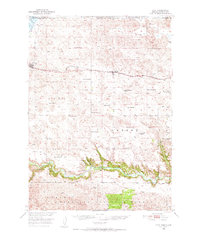 1950 Cody1952 Print · USGSCherry County ranching and rail life are at the forefront here in the early fifties as the railroad connects isolated outposts. Researchers can trace historic family lands like the Goodwin Ranch or locate vanished rural schoolhouses such as Crackerbox Sch and School No 60.2 unique versions available
 - 1950 Map of Doughboy, 1972 Print
 1950 Doughboy1972 Print · USGSCherry County ranchlands and the Sandhills lakes are captured here during the mid-twentieth century. Genealogists can locate remote rural outposts like Doughboy and several early schoolhouses including Heath Sch and School No 165.
 - 1950 Map of Wolf Lake, 1978 Print
 1950 Wolf Lake1978 Print · USGSRanching life in Cherry and Brown Counties comes into focus at mid-century, following the tracks of the CHICAGO AND NORTH WESTERN railroad. Genealogists can trace early homesteads and community centers like Porter Valley Sch and East Woodlawn Cem.
 - 1950 Map of Irwin, 1979 Print
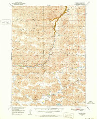
 1950 Irwin1979 Print · USGSThe Nebraska Sandhills and South Dakota borderlands are captured here at mid-century, showing a landscape of isolated ranches and scattered prairie lakes. You can trace the Chicago and North Western rail line and locate rural landmarks like School No 61 and Lions Bridge.
 - 1951 Map of Mullen
 1951 Mullen1951 Print · USGSHooker County ranching country and the Sandhills are documented here just after the war, centered on the vital rail and river hub at Mullen. Genealogists and local historians can trace rural school districts like Delight Sch and Prentice Sch or follow the Chicago Burlington and Quincy line to Hecla.2 unique versions available
 - 1951 Map of Long Lake
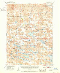
 1951 Long Lake1951 Print · USGSThe Nebraska sandhills of Cherry County come to life in this mid-century survey of the Valentine National Wildlife Refuge. Family researchers can locate historic holdings like the Schleuter Ranch and rural landmarks such as School No 149.2 unique versions available
 - 1951 Map of Irwin
 1951 Irwin1951 Print · USGSThe ranching country of northern Nebraska is captured here in the early fifties, just as the Chicago and North Western rail line shaped local commerce. Researchers can locate remote school sites like School No 124 and trace the original Niobrara River crossings at Lions Bridge.
 - 1951 Map of Seneca
 1951 Seneca1951 Print · USGSSeneca and the surrounding Nebraska Sandhills are caught mid-century along the rail-and-river corridor of the Middle Loup. Genealogists and historians can trace family ranch lands like Metz Ranch, find old schoolhouses such as Huddle Sch, and locate the James Cem burial ground.2 unique versions available
 - 1951 Map of Big Falls
 1951 Big Falls1951 Print · USGSRanching life in Cherry County during the early fifties centered on the North Loup River and its unique water features. Trace family legacies at the Cloyed Carpenter Ranch or locate historical schoolhouses like Starr Sch.2 unique versions available
 - 1951 Map of Purdum
 1951 Purdum1951 Print · USGSThe Nebraska Sandhills in the early fifties come alive on this map of cattle country along the North Loup River. Family history and local landmarks abound, from the village of Purdum to the Walking Circle Ranch and rural anchors like Cascade Sch.
 - 1951 Map of Bull Lake
 1951 Bull Lake1951 Print · USGSCherry County ranching country is documented here in the early fifties, showing a land of seasonal lakes and family-owned spreads. Genealogists can locate family landmarks like Sears Ranch, Long Cem, and rural schools including Wells Sch.2 unique versions available
 - 1951 Map of Steverson Lake
 1951 Steverson Lake1951 Print · USGSCherry County ranching country is shown here in the early fifties, where family spreads and school districts formed the backbone of the Nebraska Sandhills. Genealogists can trace family holdings like the Knudsen Ranch and Curtis Ranch or locate the historic South School No 135.2 unique versions available
Showing maps 1-25 of 41
Top cities of Cherry County
- Valentine historical maps
- Cody historical maps
- Merriman historical maps
- Kilgore historical maps
- Crookston historical maps
- Wood Lake historical maps
See more
Frequently asked questions
- What are the different types of historical maps available for Cherry County?
- What is the oldest map of Cherry County?
- Where can I purchase historical maps of Cherry County for my home or office?
- Where can I download high-res historical maps of Cherry County?
- Are there historical topographic maps available for Cherry County?
- Is there historical aerial imagery available for Cherry County?
- Where are historical maps of Cherry County sourced from?