1980s Maps of Cherry County, Nebraska
Explore 114 historic maps of Cherry County from the 1980s. These maps offer a rare glimpse into what life looked like during the 1980s — showing old roads, neighborhoods, homes, and landmarks that have changed or disappeared over time.
Whether you're researching your family's past, planning a metal detecting trip, or studying how Cherry County's landscape evolved across the 1980s, these high-resolution maps are a powerful tool for exploring the history of this region.
- Focus on a specific era: All maps on this page are from the 1980s, giving you a focused view of this time period.
- See what’s changed: Compare century-old streets, trails, and buildings to today's modern landscape using overlays and satellite layers.
- Research with precision: Use these maps for genealogy, historical research, land use analysis, or educational projects.
- View, download, or print: Maps are fully viewable online in high resolution, and can be downloaded or printed for your own records.
Start exploring Cherry County's history through authentic maps from the 1980s. This is your window into the past.
Cherry County, NE maps
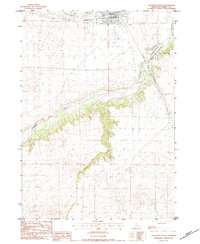
(114)- 1983 Map of Crookston East, 1984 Print
 1983 Crookston East1984 Print · USGSThe Nebraska-South Dakota borderlands are captured here in the early 1980s, centered on the Rosebud Indian Reservation. Researchers can trace the Chicago and North Western railroad as it passes through Crookston and follows the bends of Minnechadua Creek.
 - 1983 Map of Sparks, 1984 Print
 1983 Sparks1984 Print · USGSThe Niobrara River valley in Cherry County was a landscape of remote farmsteads and river crossings in the early 1980s. Researchers can locate community landmarks like Kewanee Sch and St Joseph Cem, or trace early transit points at Berry Bridge and Sparks.
 - 1983 Map of Muleshoe Creek, 1984 Print
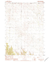
 1983 Muleshoe Creek1984 Print · USGSThe Nebraska borderlands in the early eighties were defined by the winding Niobrara River and its rugged creek systems. Researchers can trace remote ranching sites like the Owens Ranch and historic river access points such as Rocky Ford.2 unique versions available
 - 1983 Map of Valentine SW, 1984 Print
 1983 Valentine SW1984 Print · USGSThe Niobrara River valley in northern Nebraska appears here in the early 1980s, revealing a landscape shaped by hydrology and ranching. You can trace the winding course of Gordon Creek and locate several Flowing Wells used by locals to manage the surrounding Sand hills.
 - 1983 Map of Valentine North, 1984 Print
 1983 Valentine North1984 Print · USGSThe northern Nebraska borderlands and Rosebud Indian Reservation meet at the turn of the 1980s. Genealogists and historians can trace local landmarks like Richland Harmony Cem, the C & NW railroad, and the Valentine State Fish Hatchery.2 unique versions available
 - 1983 Map of Valentine South, 1984 Print
 1983 Valentine South1984 Print · USGSThe Nebraska Sandhills meet the Niobrara River valley in the early eighties as the rail line still serves the northern plains. Researchers can trace local heritage at Mt Hope Cem and the river crossings at Bryan Bridge and Borman Bridge.2 unique versions available
 - 1983 Map of Thatcher, 1984 Print
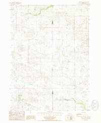
 1983 Thatcher1984 Print · USGSCherry County ranching country and the Niobrara River valley are captured here in the early 1980s. Researchers can trace family land holdings like Paxson Ranch and Hornsby Ranch, or locate the Taylor Cem along the Chicago and North Western rail line.
 - 1983 Map of Sparks SE, 1984 Print
 1983 Sparks SE1984 Print · USGSCherry County ranching country is captured here during the early eighties, showcasing the intersection of river valley hydrology and livestock operations. Researchers can locate specific family-run sites like Lazy Trails Angus Ranch and Lost Creek Cattle Co Ranch near the Niobrara River.
 - 1983 Map of Norden NW, 1984 Print
 1983 Norden NW1984 Print · USGSRanching life on the Nebraska-South Dakota border is detailed in this early 1980s survey of the High Plains. Genealogists and local historians can locate family landmarks like Lawrence Ranch, Sparks Cem, and the Shadley Creek Sch.
 - 1983 Map of Cornell Dam, 1984 Print
 1983 Cornell Dam1984 Print · USGSThe Nebraska-South Dakota borderlands along the Niobrara River are documented in the early 1980s, highlighting a significant conservation landscape. Historians can trace the infrastructure of the Cornell Dam and find landmarks like Fort Falls and the Rosebud Indian Res.
 - 1985 Map of Powderhorn Valley SW
 1985 Powderhorn Valley SW1985 Print · USGSCherry County ranching country and the Sandhills river systems are captured here in the mid-eighties. Researchers can locate the Wolfenden Ranch and trace the paths of the Snake River, Boardman Creek, and Gordon Creek.
 - 1985 Map of Long Lake
 1985 Long Lake1985 Print · USGSThe Nebraska Sandhills come into sharp focus in the mid-1980s, revealing a landscape defined by ranching and protected wetlands. Researchers can trace the legacy of local cattle operations at Pedersen Ranch or explore the shores of Long Lake and South Marsh Lake.
 - 1985 Map of Wilson Valley
 1985 Wilson Valley1985 Print · USGSCattle ranching and conservation lands define this corner of Cherry County in the mid-1980s. Researchers can trace historic homestead boundaries and water rights through landmarks like Schleuter Ranch, Rat Lake, and Valentine National Wildlife Refuge.
 - 1985 Map of Brush Creek
 1985 Brush Creek1985 Print · USGSThe Nebraska Sandhills come into focus in the mid-1980s, revealing a landscape shaped by water and private irrigation. Researchers can trace the winding Brush Creek, the path of the Ainsworth Private Canal, and the shoreline of Leach Lake.
 - 1985 Map of Kilgore SE
 1985 Kilgore SE1985 Print · USGSThe winding waters of the Niobrara River and Snake River dominate this 1980s ranching landscape in Cherry County. Researchers can trace the layout of family-held lands like Schloter Ranch and locate the historic School No 45.
 - 1985 Map of Heath Valley
 1985 Heath Valley1985 Print · USGSThe Nebraska Sandhills in the mid-1980s reveal a landscape of secluded ranches and numerous natural basins. Genealogists and researchers can trace local family holdings like the Krueger Ranch or Gale Ranch and explore landmarks such as Schoolhouse Lake.
 - 1985 Map of Eli SE
 1985 Eli SE1985 Print · USGSThe Cherry County Sandhills in the mid-1980s are defined by the winding Niobrara River and expansive ranch lands. Researchers can trace remote infrastructure like Boiling Spring Bridge and numerous Irr Wells near Medicine Creek.
 - 1985 Map of Arabia SE
 1985 Arabia SE1985 Print · USGSCherry County cattle country and Sandhills hydrology are documented here in the mid-1980s. Local researchers can trace the path of the Ainsworth Canal and the winding course of the North Fork Plum Creek across the range.
 - 1985 Map of Arabia SW
 1985 Arabia SW1985 Print · USGSCherry County ranchlands and protected wetlands are detailed in the mid-1980s, showcasing the remote character of the Nebraska Sandhills. Genealogists and historians can trace property boundaries at Rolling Stone Ranch or explore the shores of Middle Marsh Lake.
 - 1985 Map of Gordon
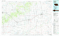 1985 Gordon1985 Print · USGSSheridan County and the High Plains thrive along the rail lines during the mid-eighties as agriculture and aviation modernize the region. Trace family roots and land patterns near Rushville, the Nebraska National Forest, and the Old Indian Treaty Boundary.2 unique versions available
 - 1985 Map of Cooper Canyon
 1985 Cooper Canyon1985 Print · USGSIn the mid-1980s, the Nebraska sandhills remain a sparsely settled landscape defined by the winding Niobrara River. Researchers can trace remote crossings at Anderson Bridge and Hockenbury Bridge or explore the boundaries of the Samuel R McKelvie National Forest.
 - 1985 Map of Cody East
 1985 Cody East1985 Print · USGSCherry County rangelands and the South Dakota border come into focus in the mid-1980s. Genealogists and local historians can trace the community of Cody, the Prairie Lawn Cem, and established family holdings like Metz Ranch.
 - 1985 Map of Farm Flat
 1985 Farm Flat1985 Print · USGSCherry County ranching country is documented here in the mid-1980s, showcasing the high flats and valleys between the river and the creeks. Researchers can trace land use at Three Bar Ranch, locate the rural School No 83, or find the old settlement at Doughboy.
 - 1985 Map of Wood Lake
 1985 Wood Lake1985 Print · USGSWood Lake and the surrounding Nebraska ranchlands are documented here in the mid-1980s. Genealogists and local historians can locate Mt Hope Cem and trace the paths of Evergreen Creek and Minnie Cr across the county line.
 - 1985 Map of Eli
 1985 Eli1985 Print · USGSThe Nebraska Sandhills near the South Dakota border are captured here in the mid-1980s, showcasing the remote ranching landscape of Cherry County. Researchers can trace the path of Bear Creek or locate the small settlement of Eli and nearby Winslow Lake.
Showing maps 1-25 of 114
Top cities of Cherry County
- Valentine historical maps
- Cody historical maps
- Merriman historical maps
- Kilgore historical maps
- Crookston historical maps
- Wood Lake historical maps
See more
Frequently asked questions
- What are the different types of historical maps available for Cherry County?
- What is the oldest map of Cherry County?
- Where can I purchase historical maps of Cherry County for my home or office?
- Where can I download high-res historical maps of Cherry County?
- Are there historical topographic maps available for Cherry County?
- Is there historical aerial imagery available for Cherry County?
- Where are historical maps of Cherry County sourced from?