
1985 Map of Eli SE
USGS Topo · Published 1985About this map
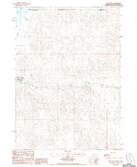
The Niobrara River carves a deep, winding valley through the Sandhills of Cherry County, defining the northern landscape of this mid-1980s survey. The river's path is marked by isolated infrastructure, including the Boiling Spring Bridge and the Mogle Bridge, which provided essential crossings for the region's ranching operations. To the south, the terrain transitions into the protected acreage of the Samuel R Mc Kelvie National Forest, where the topography is dominated by stabilized sand dunes and the drainage of Medicine Creek. This area illustrates a typical Western Nebraska land-use pattern, where human presence is characterized by scattered Irr Wells used for cattle and irrigation, rather than concentrated settlements. The map preserves the exact placement of these water sources and natural springs like Boiling Spring before further modern developments altered the local water table.
Find a feature on this map
8 named features on this map. Tap any name to fly to it.
Don’t see what you’re looking for? This feature index may not catch every label — zoom into the map to look around manually.
Map Details
Editions of this 1985 Eli SE Map
This is the sole edition of this map. No revisions or reprints were ever made.
Other maps of this area

1950 · Powderhorn Valley
USGS Topo · 1:62,500

1950 · Cody
USGS Topo · 1:62,500

1950 · Doughboy
USGS Topo · 1:62,500

1952 · Eli
USGS Topo · 1:62,500

1952 · Doughboy
USGS Topo · 1:62,500

1957 · Valentine
USGS Topo · 1:250,000

1959 · Valentine
USGS Topo · 1:250,000

1985 · Heath Valley
USGS Topo · 1:24,000
1985 · Cody East
USGS Topo · 1:24,000
1985 · Eli
USGS Topo · 1:24,000