
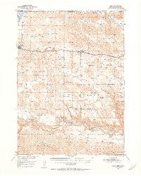
1950 Map of Cody
USGS Topo · Published 1952About this map
The Chicago and North Western railroad corridor anchors this mid-century look at Cherry County, cutting a path through the Sandhills between Cody and Nenzel. This landscape is defined by its ranching heritage, with large landholdings like Lindberg Ranch, Goodwin Ranch, and the Stasch Brothers Ranch distributed across the rolling terrain. The map captures the social infrastructure of the time, documenting rural education through the Crackerbox Sch, Hinton Sch, and School No 60. To the south, the deep incision of the Niobrara River and its tributary Snake Canyon provides a sharp contrast to the plateau. The map also shows the southern boundary of the Rosebud Indian Reservation at the South Dakota border and the northern reaches of the Nebraska National Forest.
Find a feature on this map
34 named features on this map. Tap any name to fly to it.
Don’t see what you’re looking for? This feature index may not catch every label — zoom into the map to look around manually.
Map Details
Editions of this 1950 Cody Map
2 editions found
Other maps of this area

1950 · Powderhorn Valley
USGS Topo · 1:62,500

1950 · Kennedy
USGS Topo · 1:62,500

1950 · Kilgore
USGS Topo · 1:62,500

1950 · Doughboy
USGS Topo · 1:62,500

1952 · Eli
USGS Topo · 1:62,500

1952 · Doughboy
USGS Topo · 1:62,500

1955 · Martin
USGS Topo · 1:250,000

1957 · Valentine
USGS Topo · 1:250,000

1958 · Martin
USGS Topo · 1:250,000

1959 · Valentine
USGS Topo · 1:250,000