
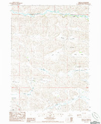
1985 Map of Heath Valley
USGS Topo · Published 1985About this map
The Samuel R Mc Kelvie National Forest dominates the northern reaches of this Nebraska Sandhills landscape, where the terrain is defined by a dense network of pocketed lakes and seasonal flats. This mid-1980s survey captures the localized water system of the region, anchored by named water bodies such as Goose Lake, Twomile Lake, and Schoolhouse Lake. The drainage pattern is further characterized by Steer Creek and the marshy expanses of Trickle Flat and Hutch Jack Flat.
Find a feature on this map
18 named features on this map. Tap any name to fly to it.
Don’t see what you’re looking for? This feature index may not catch every label — zoom into the map to look around manually.
Map Details
Editions of this 1985 Heath Valley Map
This is the sole edition of this map. No revisions or reprints were ever made.
Other maps of this area

1950 · Powderhorn Valley
USGS Topo · 1:62,500

1950 · Cody
USGS Topo · 1:62,500

1950 · Doughboy
USGS Topo · 1:62,500

1952 · Eli
USGS Topo · 1:62,500

1952 · Doughboy
USGS Topo · 1:62,500

1957 · Valentine
USGS Topo · 1:250,000

1959 · Valentine
USGS Topo · 1:250,000

1985 · Powderhorn Valley SW
USGS Topo · 1:24,000

1985 · Eli SE
USGS Topo · 1:24,000
1985 · Farm Flat
USGS Topo · 1:24,000