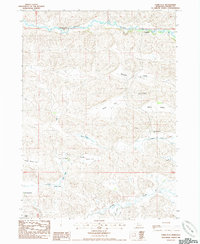
1985 Map of Farm Flat
USGS Topo · Published 1985About this map
The Snake River winds across the northern reaches of this Cherry County landscape, carving a valley defined by prominent features like Horseshoe Bend Pond and the settlement at Doughboy. This mid-1980s survey captures a transition between the river's path and the extensive tablelands to the south, where numerous flats such as Farm Flat, Winter Flat, and School Section Flat dominate the topography. These level areas reflect a long history of ranching and rural schooling, exemplified by the central location of School No 83.
Find a feature on this map
22 named features on this map. Tap any name to fly to it.
Don’t see what you’re looking for? This feature index may not catch every label — zoom into the map to look around manually.
Map Details
Editions of this 1985 Farm Flat Map
This is the sole edition of this map. No revisions or reprints were ever made.
Other maps of this area

1949 · Big Falls
USGS Topo · 1:62,500

1950 · Powderhorn Valley
USGS Topo · 1:62,500

1950 · Doughboy
USGS Topo · 1:62,500

1950 · Wolf Lake
USGS Topo · 1:62,500

1951 · Big Falls
USGS Topo · 1:62,500

1951 · Wolf Lake
USGS Topo · 1:62,500

1952 · Doughboy
USGS Topo · 1:62,500

1957 · Valentine
USGS Topo · 1:250,000

1959 · Valentine
USGS Topo · 1:250,000

1985 · Powderhorn Valley SW
USGS Topo · 1:24,000