
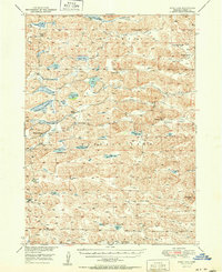
1951 Map of Wolf Lake
USGS Topo · Published 1951About this map
Isolated ranching outposts and a network of freshwater basins define this 1951 study of Nebraska’s Sandhills region. The North Loup River winds through a landscape of rolling terrain and broad valleys, including Rosebud Valley and Pullman Valley. This era of western Cherry County is characterized by large, family-named landholdings such as D Phillips Ranch, Coble Ranch, and Roseberry Ranch, many of which were supported by one-room schoolhouses like School No 131.
Find a feature on this map
45 named features on this map. Tap any name to fly to it.
Don’t see what you’re looking for? This feature index may not catch every label — zoom into the map to look around manually.
Map Details
Editions of this 1951 Wolf Lake Map
2 editions found
Other maps of this area

1948 · Mullen
USGS Topo · 1:62,500

1948 · Whitman
USGS Topo · 1:62,500

1949 · Big Falls
USGS Topo · 1:62,500

1949 · Steverson Lake
USGS Topo · 1:62,500

1950 · Whitman
USGS Topo · 1:62,500

1950 · Hire
USGS Topo · 1:62,500

1950 · Powderhorn Valley
USGS Topo · 1:62,500

1950 · Doughboy
USGS Topo · 1:62,500

1950 · Wolf Lake
USGS Topo · 1:62,500

1951 · Mullen
USGS Topo · 1:62,500