
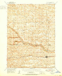
1951 Map of Mullen
USGS Topo · Published 1951About this map
The town of Mullen serves as the focal point of this mid-century survey of the Sandhills, situated at the junction of the Chicago Burlington and Quincy railroad and the Middle Loup River. The landscape is defined by the unique hydrology of the region, where numerous valley formations like Dry Valley and Valley provide corridors between the dunes. The drainage system is particularly well-documented, showing the confluence of the North Branch, Middle Branch, and South Branch as they feed into the main river channel.
Find a feature on this map
19 named features on this map. Tap any name to fly to it.
Don’t see what you’re looking for? This feature index may not catch every label — zoom into the map to look around manually.
Map Details
Editions of this 1951 Mullen Map
2 editions found
Other maps of this area

1947 · Dismal River Ranch
USGS Topo · 1:62,500

1948 · Seneca
USGS Topo · 1:62,500

1948 · Carr Lake
USGS Topo · 1:62,500

1948 · Mullen
USGS Topo · 1:62,500

1949 · Dismal River Ranch
USGS Topo · 1:62,500

1949 · Big Falls
USGS Topo · 1:62,500

1950 · Carr Lake
USGS Topo · 1:62,500

1950 · Hire
USGS Topo · 1:62,500

1950 · Shimmins Lake
USGS Topo · 1:62,500

1950 · Wolf Lake
USGS Topo · 1:62,500