
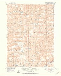
1950 Map of Carr Lake
USGS Topo · Published 1950About this map
The ranching landscape of the Sandhills is meticulously documented in this mid-century survey along the border of Grant and Hooker counties. Large, family-named operations like Carr Ranch and Riemer Ranch anchor a region defined by scattered lakes and seasonal watercourses. The hydrology of the area is particularly detailed, tracing the flow of the Dismal River and the North Fork Dismal River, alongside smaller bodies such as Rosebud Lake and Jeffery Lake. This period of Nebraska's history shows a reliance on localized community hubs, evidenced by the presence of Eclipse Ch and rural education centers like Tucker Sch and Erny Sch. The inclusion of the Running Water Bridge provides a specific reference point for local transit and river crossings that shaped the daily movements of the era's residents.
Find a feature on this map
20 named features on this map. Tap any name to fly to it.
Don’t see what you’re looking for? This feature index may not catch every label — zoom into the map to look around manually.
Map Details
Editions of this 1950 Carr Lake Map
2 editions found
Other maps of this area

1947 · Dismal River Ranch
USGS Topo · 1:62,500

1948 · Carr Lake
USGS Topo · 1:62,500

1948 · Mullen
USGS Topo · 1:62,500

1948 · Whitman
USGS Topo · 1:62,500

1948 · Spring Valley
USGS Topo · 1:62,500

1949 · Arthur
USGS Topo · 1:62,500

1949 · Dismal River Ranch
USGS Topo · 1:62,500

1949 · Flats
USGS Topo · 1:62,500

1949 · Wright Valley
USGS Topo · 1:62,500

1950 · Flats
USGS Topo · 1:62,500