
1950 Map of Hire
USGS Topo · Published 1950About this map
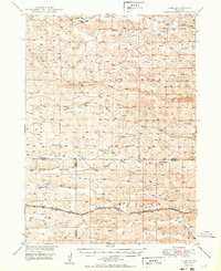
The North Branch Middle Loup River, Middle Branch Middle Loup River, and South Branch Middle Loup River converge in this high plains landscape of the Sandhills. The settlement of Hire sits as a quiet focal point in the northwest, while the southern portion of the sheet is defined by the Chicago Burlington and Quincy railroad line, which follows a steady eastward path toward Mullen.
Find a feature on this map
16 named features on this map. Tap any name to fly to it.
Don’t see what you’re looking for? This feature index may not catch every label — zoom into the map to look around manually.
Map Details
Editions of this 1950 Hire Map
3 editions found
Other maps of this area

1947 · Dismal River Ranch
USGS Topo · 1:62,500

1948 · Carr Lake
USGS Topo · 1:62,500

1948 · Mullen
USGS Topo · 1:62,500

1948 · Whitman
USGS Topo · 1:62,500

1948 · Spring Valley
USGS Topo · 1:62,500

1949 · Dismal River Ranch
USGS Topo · 1:62,500

1949 · Big Falls
USGS Topo · 1:62,500

1949 · Steverson Lake
USGS Topo · 1:62,500

1950 · Spring Valley
USGS Topo · 1:62,500

1950 · Whitman
USGS Topo · 1:62,500