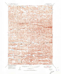
1950 Map of Hire
USGS Topo · Published 1950About this map
The Middle Loup River system dominates this Sandhills landscape, where the North Branch and South Branch converge amidst a complex network of dunes and valleys. In the late 1940s, the Chicago Burlington and Quincy railroad provided the primary transportation artery through this ranching country, passing through the small station at Weir. The settlement pattern is sparse, reflecting the massive scale of Nebraska's cattle country where community life centered on rural institutions like Cox Sch and School No 1. Significant hydrologic features such as Calf Creek, Fender Lake, and a Flowing Well indicate the vital importance of water access in this semi-arid region. Terrain landmarks like Black Eye and Middle Prong serve as navigational anchors for researchers tracing old ranch boundaries and land use across the Cherry, Grant, and Hooker county lines.
Find a feature on this map
15 named features on this map. Tap any name to fly to it.
Don’t see what you’re looking for? This feature index may not catch every label — zoom into the map to look around manually.
Map Details
Editions of this 1950 Hire Map
3 editions found

Other maps of this area

1947 · Dismal River Ranch
USGS Topo · 1:62,500

1948 · Carr Lake
USGS Topo · 1:62,500

1948 · Mullen
USGS Topo · 1:62,500

1948 · Whitman
USGS Topo · 1:62,500

1948 · Spring Valley
USGS Topo · 1:62,500

1949 · Dismal River Ranch
USGS Topo · 1:62,500

1949 · Big Falls
USGS Topo · 1:62,500

1949 · Steverson Lake
USGS Topo · 1:62,500

1950 · Spring Valley
USGS Topo · 1:62,500

1950 · Whitman
USGS Topo · 1:62,500