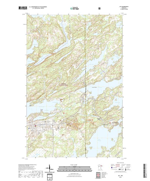
2022 Map of Ely
USGS Topo · Published 2022About this map
The town of Ely and the neighboring settlement of Winton serve as gateways to the lakes and trails of the Superior National Forest. This landscape is defined by its complex glacial hydrology, where major water bodies like Shagawa Lake, Fall Lake, and White Iron Lake are interconnected by the Shagawa River and numerous smaller creeks. Cultural landmarks such as the Vermilion Community College and Ely Cem anchor the community, while the presence of Miners Lake hints at the area's industrial heritage within the iron range.
Find a feature on this map
79 named features on this map. Tap any name to fly to it.
Don’t see what you’re looking for? This feature index may not catch every label — zoom into the map to look around manually.
Map Details
Editions of this 2022 Ely Map
This is the sole edition of this map. No revisions or reprints were ever made.
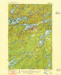
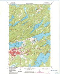
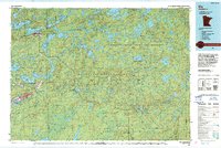
Historical Maps of Section Thirty Through Time
5 maps found