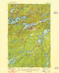
1939 Map of Ely
USGS Topo · Published 1949About this map
The iron mining town of Ely serves as the focal point of this 1930s survey, illustrating the industrial footprint of the Vermilion Range. Major operations like the Pioneer Mine and Zenith Mine are situated directly adjacent to the settlement, connected to the wider world via the Duluth Missabe and Northern Ry. Beyond the industrial core, the map captures a landscape transitioning toward recreation and conservation within the Superior National Forest.
Find a feature on this map
94 named features on this map. Tap any name to fly to it.
Don’t see what you’re looking for? This feature index may not catch every label — zoom into the map to look around manually.
Map Details
Editions of this 1939 Ely Map
3 editions found
Other maps of this area

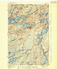
1933 · Ely
USGS Topo · 1:62,500

1939 · Ely
USGS Topo · 1:62,500

1949 · Isaac Lake
USGS Topo · 1:24,000

1950 · Isaac Lake
USGS Topo · 1:24,000

1951 · Babbitt
USGS Topo · 1:24,000

1952 · Babbitt NE
USGS Topo · 1:24,000

1954 · Greenwood Lake
USGS Topo · 1:62,500

1954 · Two Harbors
USGS Topo · 1:250,000

1954 · Hibbing
USGS Topo · 1:250,000

1954 · International Falls
USGS Topo · 1:250,000