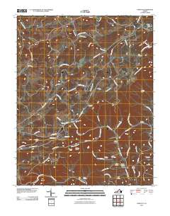
2010 Map of Endicott
USGS Topo · Published 2010About this map
Pizarro and Smart sit along the winding path of the Blue Ridge Pkwy, illustrating the intersection of historic highland settlements with mid-twentieth century scenic infrastructure. The terrain is defined by the sharp descent of the Blue Ridge escarpment, where headwaters like Shooting Creek and Rennet Bag Creek carve deep hollows as they drop toward the lowlands. This topography dictated a settlement pattern of isolated farmsteads and family-centric communities, evidenced by the high density of small burial grounds throughout the quadrangle.
Find a feature on this map
70 named features on this map. Tap any name to fly to it.
Don’t see what you’re looking for? This feature index may not catch every label — zoom into the map to look around manually.
Map Details
Editions of this 2010 Endicott Map
This is the sole edition of this map. No revisions or reprints were ever made.
Other maps of this area

1890 · Christiansburg
USGS Topo · 1:125,000

1932 · Blacksburg
USGS Topo · 1:48,000

1937 · Blacksburg
USGS Topo · 1:62,500

1950 · Elliston
USGS Topo · 1:62,500

1953 · Winston-Salem
USGS Topo · 1:250,000

1955 · Bluefield
USGS Topo · 1:250,000

1955 · Winston-Salem
USGS Topo · 1:250,000

1957 · Endicott
USGS Topo · 1:62,500

1957 · Floyd
USGS Topo · 1:62,500

1957 · Bluefield
USGS Topo · 1:250,000