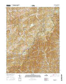
2016 Map of Endicott
USGS Topo · Published 2016About this map
The Blue Ridge Parkway winds through this section of the Blue Ridge Mountains along the border of Floyd and Franklin counties. The landscape is defined by the headwaters of several major water systems, where the Pigg River and S Prong Pigg River begin their descent. Small communities like Pizarro and Endicott serve as focal points for the rural road network, which includes historic routes like Franklin Pike SE and Cannadays Gap Rd NE. For genealogists, the map is remarkably dense with family burial sites, including Huff Cem, Midkiff Cem, Nolen Cem, and Spencer Cem. Notable high points such as Shortts Knob, Fivemile Mtn, and Turners Knob overlook a terrain carved by Roaring Run, Rennet Bag Cr, and Little River. This survey captures the enduring rural character of these mountain ridges, where the placement of cemeteries and local landmarks like Cracker Point reflects generations of settlement patterns.
Find a feature on this map
102 named features on this map. Tap any name to fly to it.
Don’t see what you’re looking for? This feature index may not catch every label — zoom into the map to look around manually.
Map Details
Editions of this 2016 Endicott Map
This is the sole edition of this map. No revisions or reprints were ever made.
Other maps of this area

1890 · Christiansburg
USGS Topo · 1:125,000

1932 · Blacksburg
USGS Topo · 1:48,000

1937 · Blacksburg
USGS Topo · 1:62,500

1950 · Elliston
USGS Topo · 1:62,500

1953 · Winston-Salem
USGS Topo · 1:250,000

1955 · Bluefield
USGS Topo · 1:250,000

1955 · Winston-Salem
USGS Topo · 1:250,000

1957 · Endicott
USGS Topo · 1:62,500

1957 · Floyd
USGS Topo · 1:62,500

1957 · Bluefield
USGS Topo · 1:250,000