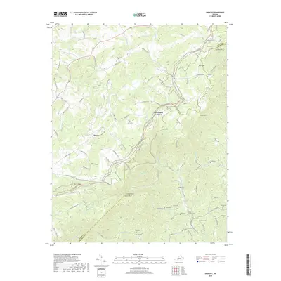
2019 Map of Endicott
USGS Topo · Published 2019About this map
The Blue Ridge Pkwy snakes through this high-elevation terrain, tracing the divide between Floyd and Franklin counties. This landscape is defined by the headwaters of the Pigg River and the Little River, where steep ridges like Fivemile Mtn and Barton Spur overlook a network of narrow creek valleys. The settlement at Endicott serves as a local hub, surrounded by a high concentration of family burial grounds including the Endicott Community Cem, McAlexander Cem, and Midkiff Cem. Further west, the small community of Pizarro sits along the Franklin Pike SE, illustrating the persistent rural character of these upland areas. The map details a complex system of mountain roads such as Stagecoach Run SE and Foggy Bottom Rd SE, reflecting the winding transportation routes necessary to navigate the ridges and gaps of the Blue Ridge.
Find a feature on this map
109 named features on this map. Tap any name to fly to it.
Don’t see what you’re looking for? This feature index may not catch every label — zoom into the map to look around manually.
Map Details
Editions of this 2019 Endicott Map
This is the sole edition of this map. No revisions or reprints were ever made.
Other maps of this area

1890 · Christiansburg
USGS Topo · 1:125,000

1932 · Blacksburg
USGS Topo · 1:48,000

1937 · Blacksburg
USGS Topo · 1:62,500

1950 · Elliston
USGS Topo · 1:62,500

1953 · Winston-Salem
USGS Topo · 1:250,000

1955 · Bluefield
USGS Topo · 1:250,000

1955 · Winston-Salem
USGS Topo · 1:250,000

1957 · Endicott
USGS Topo · 1:62,500

1957 · Floyd
USGS Topo · 1:62,500

1957 · Bluefield
USGS Topo · 1:250,000