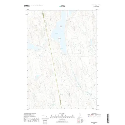
2018 Map of Endless Lake
USGS Topo · Published 2018About this map
Endless Lake dominates this north-woods interior, where the border between Piscataquis Co and Penobscot Co cuts through a landscape of extensive wetlands and glacial water bodies. The terrain is characterized by massive bog systems, including the One Thousand Acre Bog and Caribou Bog, which suggest a low-lying, saturated environment historically used for timber harvesting. Transportation is minimal, primarily represented by the Hardy Brook Truck Rd, reflecting the area's primary role as managed forest land. Distinctive landmarks such as Big Island and Blueberry Island rise from the waters of Endless Lake, while the eastern edge of the quadrangle is defined by the elevation of Miller Ridge. Numerous smaller basins like Turtle Pond and Lard Pond are connected by drainage networks including Roaring Brook and the West Branch Seboeis Stream.
Find a feature on this map
21 named features on this map. Tap any name to fly to it.
Don’t see what you’re looking for? This feature index may not catch every label — zoom into the map to look around manually.
Map Details
Editions of this 2018 Endless Lake Map
This is the sole edition of this map. No revisions or reprints were ever made.
Other maps of this area

1942 · Lincoln
USGS Topo · 1:62,500

1947 · Schoodic
USGS Topo · 1:62,500

1949 · Schoodic
USGS Topo · 1:62,500

1951 · Norcross
USGS Topo · 1:62,500

1951 · Millinocket
USGS Topo · 1:62,500

1954 · Millinocket
USGS Topo · 1:250,000

1957 · Lincoln
USGS Topo · 1:62,500

1958 · Millinocket
USGS Topo · 1:250,000

1960 · Millinocket
USGS Topo · 1:250,000

1975 · Millinocket SW
USGS Topo · 1:24,000
Featured Places
- Lake View Plantation, ME
- Seboeis Plantation, ME
- T4 R9 NWP, ME
- Cedar Lake Township, ME
- Penobscot County, ME