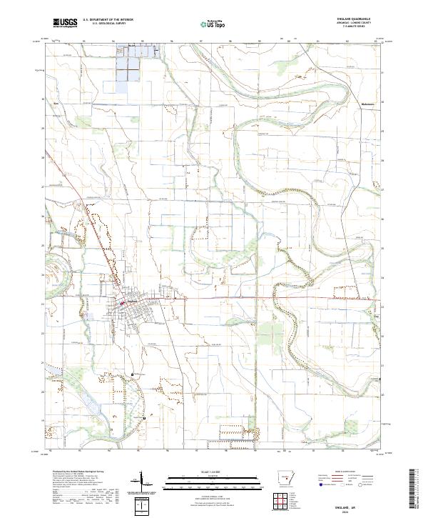
2024 Map of England
USGS Topo · Published 2024About this map
The town of England serves as the central hub of this agricultural landscape in Lonoke County, where a grid of rural roads and section lines organizes the fertile lowlands of the Arkansas Delta. The area is defined by a complex network of meandering waterways, including Bakers Bayou, Wabbaseka Bayou, and Indian Bayou, which snake through the terrain and create natural boundaries between farm tracts. Small rural settlements like Keo, Blakemore, and Coy anchor the outlying corners of the quadrangle, reflecting the region's long-standing connection to large-scale cultivation. Genealogists will find several burial sites preserved among the fields, such as Mulberry Cem, Nelon Cem, and Tomberlin Cem. The presence of distinctive features like Nelon Brake and Carlee Brake suggests the low-lying, often saturated character of the landscape, where drainage and water management remain central to the local geography.
Find a feature on this map
74 named features on this map. Tap any name to fly to it.
Don’t see what you’re looking for? This feature index may not catch every label — zoom into the map to look around manually.
Map Details
Editions of this 2024 England Map
This is the sole edition of this map. No revisions or reprints were ever made.
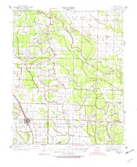
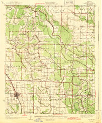
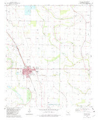
Historical Maps of Keo Through Time
4 maps found