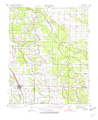
1937 Map of England
USGS Topo · Published 1982About this map
Agricultural life in Lonoke County centers on England and the St Louis Southwestern Ry corridor in this mid-1930s survey. The landscape is defined by an intricate network of waterways including Bakers Bayou, Indian Bayou, and the Crooked Creek drainage system, which shaped the development of townships like Richwoods and Gum Woods. This era was characterized by a dense distribution of rural schools and churches that served small farming communities, many of which are preserved here such as Tomberlins Sch and Steel Bridge Ch.
Find a feature on this map
60 named features on this map. Tap any name to fly to it.
Don’t see what you’re looking for? This feature index may not catch every label — zoom into the map to look around manually.
Map Details
Editions of this 1937 England Map
3 editions found
Other maps of this area

1891 · Little Rock
USGS Topo · 1:125,000

1893 · Little Rock
USGS Topo · 1:125,000

1932 · Pastoria
USGS Topo · 1:62,500

1935 · Altheimer
USGS Topo · 1:62,500

1935 · Hazen
USGS Topo · 1:62,500

1935 · Pastoria
USGS Topo · 1:62,500

1937 · Stuttgart
USGS Topo · 1:62,500

1937 · England
USGS Topo · 1:48,000

1939 · Keo
USGS Topo · 1:31,680

1939 · Stuttgart
USGS Topo · 1:62,500