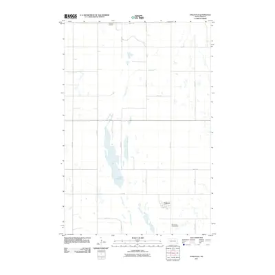
2011 Map of Englevale
USGS Topo · Published 2011About this map
Englevale serves as the primary hub of this Ransom County landscape, situated amidst a distinctive network of prairie water bodies. The hydrology of the region is defined by the elongated Englevale Slough, which stretches across the terrain to meet Lone Tree Lake. This 2011 survey reflects the enduring agricultural character of the North Dakota plains, where a rigid grid of section roads like 63rd St SE and 118th Ave SE organizes the expansive farmland. Local history is anchored by the Stiklestad Cemetery in the northern section, while modern rural utility is noted at the Streich Farm Landing Strip. The map illustrates the specialized infrastructure of the Great Plains, where transport is facilitated by key routes such as County Rd 129.
Find a feature on this map
19 named features on this map. Tap any name to fly to it.
Don’t see what you’re looking for? This feature index may not catch every label — zoom into the map to look around manually.
Map Details
Editions of this 2011 Englevale Map
This is the sole edition of this map. No revisions or reprints were ever made.
Other maps of this area

1895 · Lamoure
USGS Topo · 1:125,000

1897 · Tower
USGS Topo · 1:125,000

1897 · Eckelson
USGS Topo · 1:125,000

1918 · La Moure
USGS Topo · 1:125,000

1953 · Jamestown
USGS Topo · 1:250,000

1953 · Fargo
USGS Topo · 1:250,000

1956 · Fargo
USGS Topo · 1:250,000

1956 · Jamestown
USGS Topo · 1:250,000

1957 · Elliott SW
USGS Topo · 1:24,000

1957 · Elliott SE
USGS Topo · 1:24,000